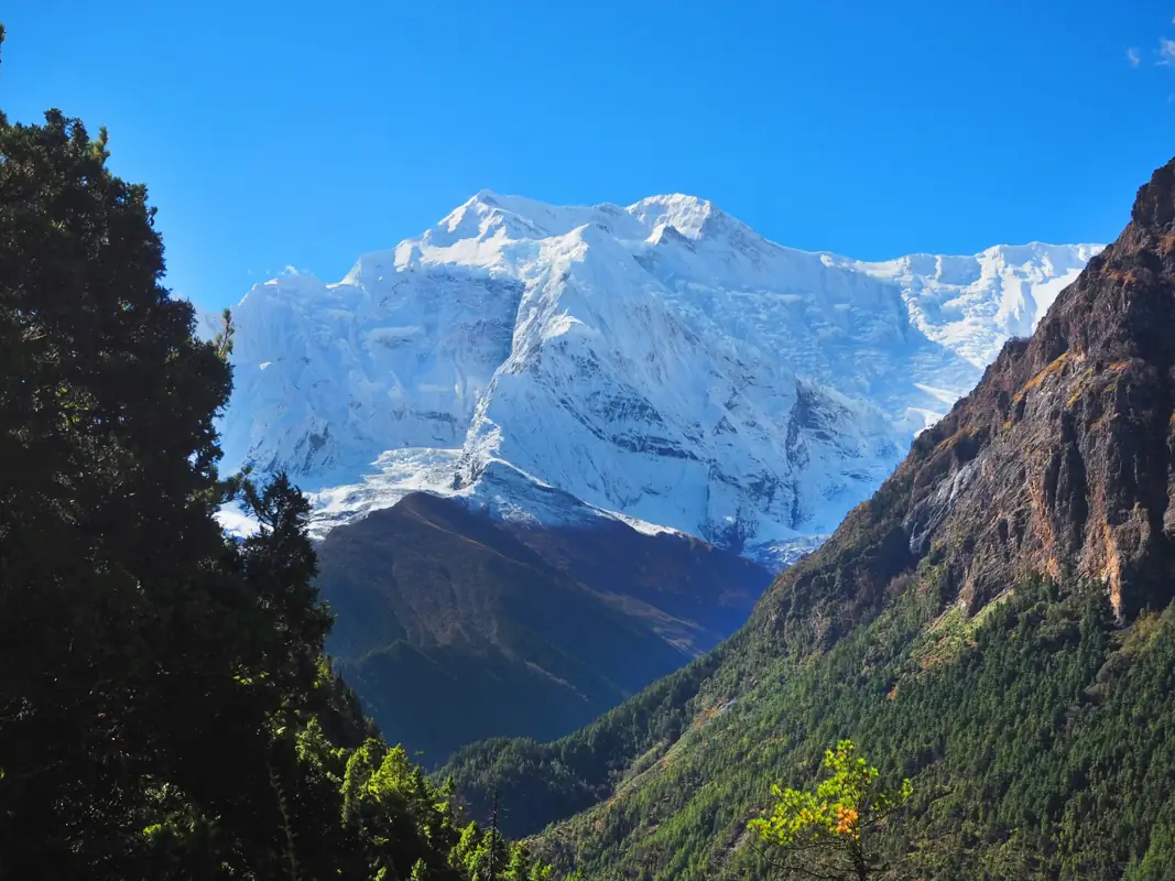
Annapurna region trekking scenery
πŸ”οΈ 8 Treks

Annapurna Region Treks

Annapurna region treks from Pokhara: Base Camp, the Circuit and Thorong La, Poon Hill, Mardi Himal and Upper Mustang, with permits and best months.

πŸ₯Ύ
Treks
8
πŸ”οΈ
Max Altitude
5416m
πŸ“Š
Difficulty
Easy to Hard
πŸ“…
Duration
4–14 days
πŸ“
Permits
Restricted area

Treks in Annapurna

Annapurna Base Camp Trek
Annapurna Regionmoderate

Annapurna Base Camp Trek

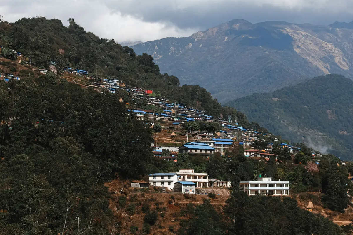
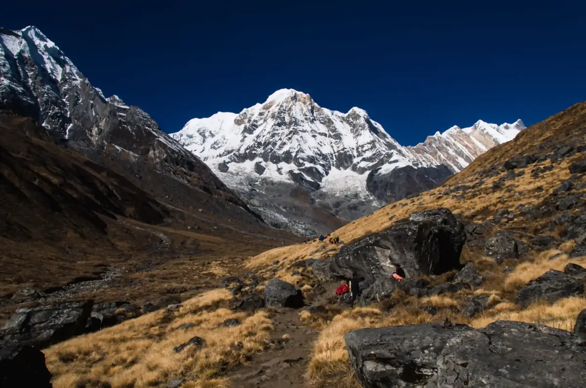
The Annapurna Base Camp Trek climbs from the foothills north of Pokhara into the Annapurna Sanctuary, a high glacial basin ringed by Annapurna I, Annapurna South, Hiunchuli and the fishtail summit of Machapuchare. The camp at about 4,130 m sits inside that amphitheatre, and sunrise on the surrounding peaks is the reason most people come. The lower trail passes Gurung villages such as Ghandruk and Chhomrong, terraced fields and stone staircases, then follows the Modi Khola gorge through bamboo and rhododendron forest. Above Deurali the valley narrows and the vegetation thins before opening into the Sanctuary at Machapuchare Base Camp. The route reaches a lower altitude than the Everest region and is shorter overall, which makes it a good first Himalayan trek for fit walkers. It is still hard work: the stone steps around Chhomrong are relentless, and the gorge above Bamboo can carry avalanche risk after heavy snow, so conditions need checking in winter and early spring. Nights are spent in teahouses along the whole route, and the return passes the natural hot springs at Jhinu Danda, a welcome stop for tired legs. A licence-verified guide you contact directly will know current trail conditions in the gorge and can plan the pace around how you are acclimatising.

πŸ“– View Details & Itinerary

πŸ“… Duration: 7-12 Days

πŸ”οΈ Max Altitude: 4130m

πŸ“ Permit: Standard Parks

Annapurna Circuit Trek
Annapurna Regionhard

Annapurna Circuit Trek

The Annapurna Circuit loops around the Annapurna massif, climbing the Marsyangdi valley on the east side, crossing the Thorong La pass at 5,416 m, and dropping into the Kali Gandaki valley on the west. Over two to three weeks the landscape changes from rice terraces and subtropical forest to pine and juniper, then to the dry, high plateau around Manang and Muktinath, which sits in the rain shadow of the Himalaya. The route passes through Gurung, Manangi and Thakali villages, Buddhist gompas and chortens, and the Hindu and Buddhist pilgrimage site of Muktinath. Teahouses are found in every village, so you sleep indoors and eat in lodge dining rooms along the whole route. Roads now reach far up both valleys, and most trekkers take a jeep for the lower sections and walk from around Dharapani or Chame. Quieter footpaths on the opposite bank of the river, such as the upper route via Ghyaru and Ngawal, avoid much of the traffic. The crossing day is long and starts before dawn, which is why an acclimatisation day in Manang matters. The trek suits fit walkers with some hiking experience who are comfortable with several days above 4,000 m. A licence-verified guide you contact directly can adjust the pace, choose the quieter trails and judge conditions on the pass.

πŸ“– View Details & Itinerary

πŸ“… Duration: 14-21 Days

πŸ”οΈ Max Altitude: 5416m

πŸ“ Permit: Standard Parks

Ghorepani Poon Hill Trek
Annapurna Regioneasy

Ghorepani Poon Hill Trek

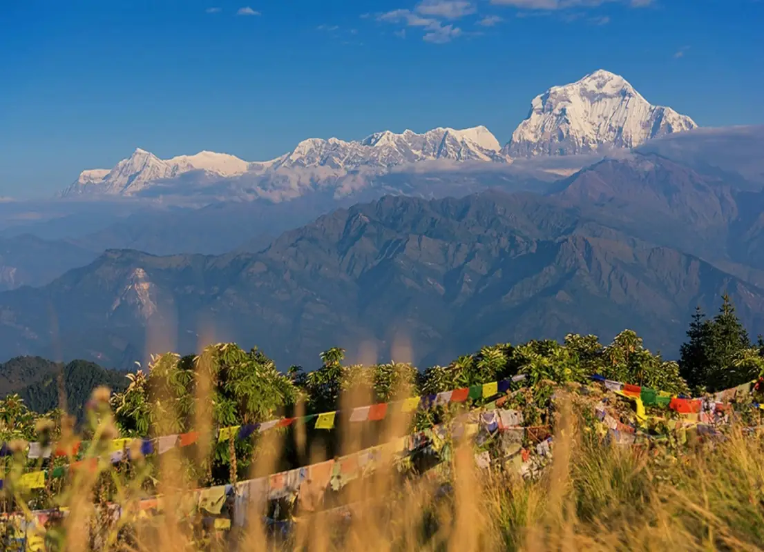
The Ghorepani Poon Hill trek is a short loop in the foothills west of Pokhara, climbing through Magar and Gurung villages and rhododendron forest to Poon Hill at 3,210 m. From the top, the sunrise view takes in Dhaulagiri, the Annapurna range, Machapuchare and many lesser peaks across the skyline. Most of the trek stays below 3,000 m, so altitude is rarely a concern, but the trail involves long stone staircases, especially the climb from Tikhedhunga to Ulleri. Days are moderate in length, and lodges are plentiful in every village, from Ulleri and Ghorepani on the ridge to Tadapani and the stone-built Gurung village of Ghandruk on the way down. It suits first-time trekkers, families with active children, and anyone short on time who wants a taste of Himalayan trekking without high altitude. In March and April the rhododendron forests flower in red and pink; in autumn and winter the skies are usually clearest for the mountain views. A licence-verified local guide you contact directly can arrange permits and transport from Pokhara, time the Poon Hill climb for the clearest sunrise, and explain the villages and culture along the way.

πŸ“– View Details & Itinerary

πŸ“… Duration: 4-7 Days

πŸ”οΈ Max Altitude: 3210m

πŸ“ Permit: Standard Parks

Jomsom Muktinath Trek
Annapurna Regionmoderate

Jomsom Muktinath Trek

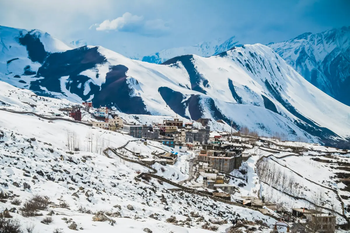
The Jomsom Muktinath Trek is a short walk into the dry upper Kali Gandaki valley, on the edge of Mustang. After a mountain flight from Pokhara to Jomsom, it follows the wide river bed to the old village of Kagbeni, then climbs to Muktinath, a temple complex at about 3,710–3,800 m sacred to both Hindus and Buddhists, known for its 108 water spouts and a natural gas flame that burns beside a spring. The landscape is closer to Tibet than to the green hills of Pokhara: wind-carved cliffs, flat-roofed stone villages, apple orchards and chortens, with Dhaulagiri and Nilgiri above the valley. Thakali and Tibetan-influenced culture is everywhere, especially in Kagbeni and Marpha. A road now runs the length of the valley, so jeeps and motorbikes share parts of the route. Good itineraries use side trails where they exist and keep road walking short. The trek suits people with limited time, pilgrims, and walkers who want altitude and scenery without long climbs; days are moderate, though afternoon wind in the valley is strong. The Pokhara–Jomsom flight depends on morning weather, so build in a spare day. Licence-verified guides you contact directly can explain which trails they use to avoid the road.

πŸ“– View Details & Itinerary

πŸ“… Duration: 7-10 Days

πŸ”οΈ Max Altitude: 3800m

πŸ“ Permit: Standard Parks

Mardi Himal Trek
Annapurna Regionmoderate

Mardi Himal Trek

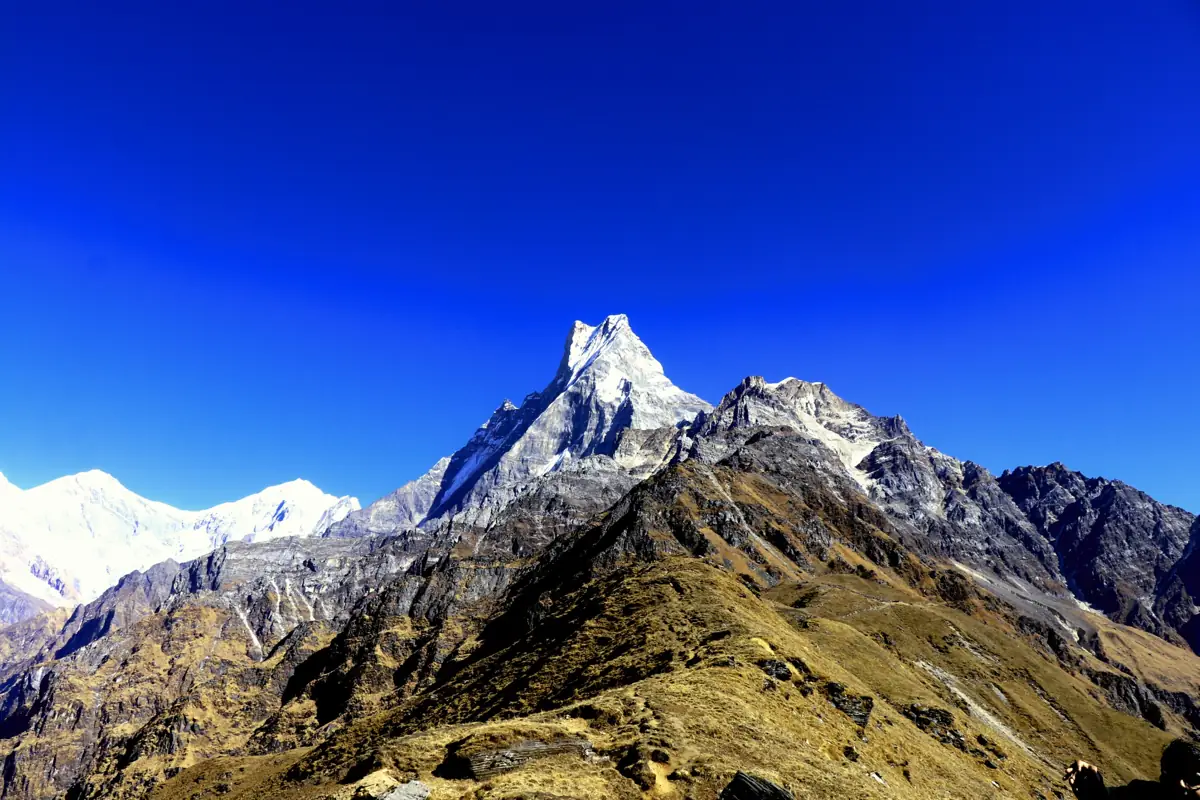
The Mardi Himal Trek follows a forested ridge north of Pokhara up towards the base of Mardi Himal and the south face of Machapuchare, the fishtail peak that is closed to climbing. It was opened to trekkers in 2012, so it sees far fewer walkers than the nearby Annapurna Base Camp route, and most of its lodges sit on the ridge itself rather than in valley villages. The first days climb through rhododendron and oak forest, which flowers red and pink in spring. Above Low Camp the trees thin out and the trail runs along an open, grassy ridge with the Annapurna South, Hiunchuli and Machapuchare massifs filling the view ahead and the Pokhara valley dropping away behind. The turnaround is usually the viewpoint or upper base camp above High Camp, reached on an early-morning walk, before you descend to the Gurung villages around Siding. The trek suits walkers who want real Himalayan views in under a week without a long approach. Days are short, typically four to six hours, but the ridge is steep in places and the upper camps are simple, so a reasonable level of fitness helps. A licence-verified local guide you contact directly can plan the pace, book the small upper lodges and adjust the route to the weather.

πŸ“– View Details & Itinerary

πŸ“… Duration: 5-7 Days

πŸ”οΈ Max Altitude: 4500m

πŸ“ Permit: Standard Parks

Sikles Trek
Annapurna Regioneasy

Sikles Trek

The Sikles Trek is a short route into the hills north of Pokhara, below the south face of Lamjung Himal and Annapurna II. A rough road climbs the Madi valley to Sikles, one of the largest Gurung villages in the Annapurna Conservation Area, where stone houses, flagged lanes and terraced millet fields spread across a steep slope. From Sikles the trail heads up the Madi Khola to Hugu Goth, a herders' clearing, and on to Kapuche Lake, a glacial lake at roughly 2,450–2,550 m fed by the ice falling from Lamjung Himal. It is a lake you reach early in the morning, before cloud fills the valley. The return loops through Tara Hill, a forested ridge with views back across the Annapurna and Lamjung peaks. The altitudes are modest, so acclimatisation is not a concern, but some days are long and steep, and facilities above Sikles are basic: herders' shelters, simple teahouses or tents depending on the season and the operator. It suits trekkers who want village life and a quiet glacier lake within a week of Pokhara, without the busy Annapurna trails. Licence-verified guides you contact directly can tell you whether they camp at the lake or stay lower down.

πŸ“– View Details & Itinerary

πŸ“… Duration: 5-7 Days

πŸ”οΈ Max Altitude: 2546m

πŸ“ Permit: Standard Parks

Tilicho Lake Trek
Annapurna Regionhard

Tilicho Lake Trek

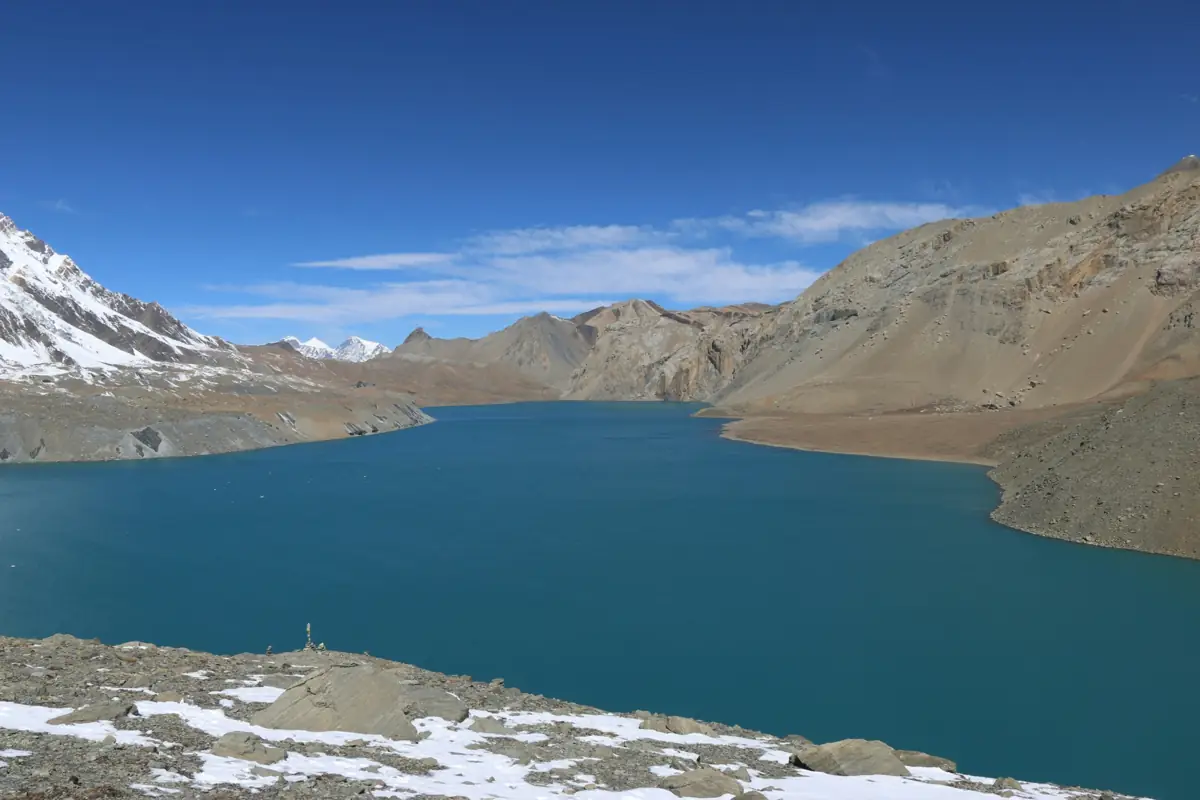
The Tilicho Lake Trek is a side route off the Annapurna Circuit. From Manang it leaves the main trail and follows a high, exposed path through Khangsar and Shree Kharka to Tilicho Base Camp, then climbs to Tilicho Lake at about 4,919 m, a large glacial lake beneath the north face of the Annapurna massif. After the lake the route rejoins the circuit at Yak Kharka and crosses the Thorong La (5,416 m) to Muktinath. The approach follows the Marsyangdi valley, where roads now reach well up the lower sections, so most itineraries use jeeps for the first part and start walking higher up. The trail between Shree Kharka and base camp crosses steep scree slopes where rockfall is a real hazard, and is best walked early in the day. Lodges on the Tilicho detour are basic, and the lake day is long and cold. It suits trekkers who have some high-altitude experience or are willing to follow a careful acclimatisation schedule, and who want a quieter, more remote variation on the circuit. Because it combines two big high points, the lake and the pass, it needs good fitness and some flexibility for weather. Licence-verified guides you contact directly can explain how they handle the rockfall section and the Thorong La crossing.

πŸ“– View Details & Itinerary

πŸ“… Duration: 10-14 Days

πŸ”οΈ Max Altitude: 5416m

πŸ“ Permit: Standard Parks

Upper Mustang Trek
Annapurna Regionhard

Upper Mustang Trek

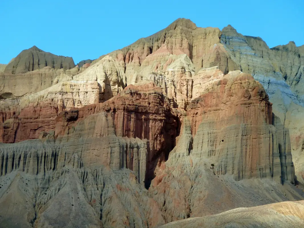
Upper Mustang is the former Kingdom of Lo, a high, dry valley north of the Annapurna and Dhaulagiri ranges that sits in their rain shadow. The trek follows the Kali Gandaki north from Kagbeni to the walled town of Lo Manthang, through a landscape of eroded cliffs, red and ochre ridges, cave dwellings and small irrigated oases of barley and apple orchards. Culturally, the region is closely tied to Tibet. Villages such as Ghami, Tsarang and Lo Manthang have whitewashed houses with firewood stacked on the roofs, centuries-old monasteries, long mani walls and chortens painted in the region's traditional red, white and grey. Lo Manthang's monasteries and the nearby cave sites are a highlight of the rest day. Walking days are moderate in length but exposed: the trail crosses several passes around 3,500–4,000 m, and afternoons often bring strong, dusty winds up the valley. Because so little rain reaches the plateau, the trek is one of the few in Nepal that stays walkable through the summer monsoon, while winters are bitterly cold and many residents move south. Upper Mustang is a restricted area with a costly permit, so it suits trekkers who want a quieter, culture-focused route rather than close-up high peaks. A licence-verified guide you contact directly can help arrange the permit through an agency and plan the pace around the passes.

πŸ“– View Details & Itinerary

πŸ“… Duration: 12-14 Days

πŸ”οΈ Max Altitude: 4230m

πŸ“ Permit: Restricted (β‰ˆ US$532 in permits)

Find a licensed guide who works in the Annapurna region and arrange your trek with them directly.

Trekking in the Annapurna region

The Annapurna region is Nepal's most varied trekking area, and the easiest to reach: most treks start a short drive from the lakeside city of Pokhara. Almost all of it lies inside the Annapurna Conservation Area, Nepal's largest protected area at about 7,629 kmΒ². It began as a pilot project in 1986, was gazetted in 1992, and is managed by the National Trust for Nature Conservation.

The region is named after Annapurna I (8,091 m), the first 8,000-metre peak ever climbed, by a French expedition in June 1950. West of it, the Kali Gandaki river cuts between Annapurna and Dhaulagiri (8,167 m), a gorge often called the deepest in the world when measured from the river to the summits on either side.

Routes for every level

  • Ghorepani Poon Hill and Sikles are short, lower treks through Gurung villages and rhododendron forest, good for a first trek or a short holiday.
  • Mardi Himal climbs a narrow ridge to a viewpoint under the fishtail summit of Machhapuchhre, a mountain that has stayed closed to climbers for decades.
  • Annapurna Base Camp walks up the Modi Khola gorge into the Annapurna Sanctuary, a ring of peaks around the base camp at 4,130 m.
  • Annapurna Circuit circles the massif over Thorong La (5,416 m), passing from green rice terraces into the dry, Tibetan-influenced valleys of Manang and Mustang.
  • Tilicho Lake adds a detour from Manang to one of Nepal's highest large lakes, at about 4,919 m.
  • Jomsom Muktinath follows the Kali Gandaki to Muktinath, a temple at about 3,760 m sacred to both Hindus and Buddhists.
  • Upper Mustang heads north to the walled town of Lo Manthang, in an area opened to foreign trekkers only in 1992.

Seasons

Most Annapurna routes are at their best in spring and autumn. Upper Mustang is different: it lies in the rain shadow behind the Annapurna and Dhaulagiri ranges, so its trek page recommends the summer months too.

Permits and guides

Every route here needs the Annapurna Conservation Area permit, and the Nepal Tourism Board lists them among the routes that need a licensed guide and an agency-issued TIMS card. Upper Mustang is a restricted area: since a cabinet decision in November 2025 its permit costs US$50 per person per day, issued through a registered agency. The figures for each trek are on its page and in our Nepal trekking permits guide.

Annapurna Trekking FAQ

How many treks are in the Annapurna region?

xTrekka currently features 8 treks in the Annapurna region, ranging from 4–14 days in length and reaching up to 5,416 m.

How difficult are Annapurna treks?

Annapurna treks range across easy to hard difficulty. Each trek page lists its difficulty grade, max altitude and daily itinerary so you can match a route to your experience.

Do I need special permits for Annapurna?

Only some. Upper Mustang Trek enters a restricted area and needs a restricted-area permit through a registered agency with a licensed guide; the other Annapurna treks use standard park or conservation area permits. Each trek page shows its permit fees in rupees with an approximate dollar figure. See our guide to Nepal trekking permits for every fee and rule.

When is the best time to trek in Annapurna?

Most Annapurna treks are best in Mar–May, Oct–Nov. Upper Mustang Trek is also recommended in the summer monsoon (June–August), because much of the route lies in the drier rain shadow north of the main Himalayan range. Each trek page shows its own best months. Compare every route in our month-by-month guide to trekking in Nepal.

Plan your Annapurna trek