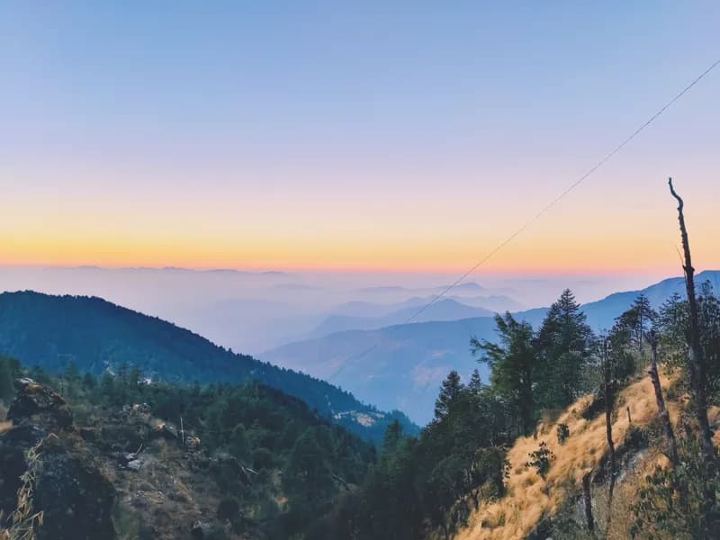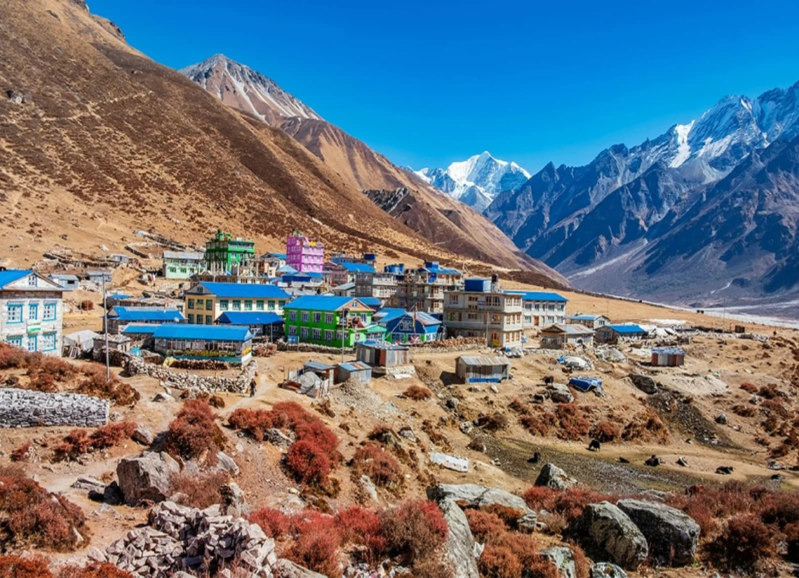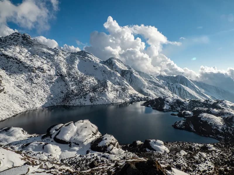
Langtang region trekking scenery
πŸ”οΈ 7 Treks

Langtang Region Treks

Langtang region treks north of Kathmandu: the Langtang Valley, Tserko Ri, Gosainkunda's sacred lakes, Helambu and the Tamang Heritage Trail.

πŸ₯Ύ
Treks
7
πŸ”οΈ
Max Altitude
4984m
πŸ“Š
Difficulty
Easy to Hard
πŸ“…
Duration
7–12 days
πŸ“
Permits
Standard parks

Treks in Langtang

Gosainkunda Lake Trek
Langtang Regionhard

Gosainkunda Lake Trek

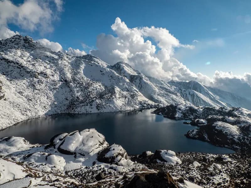
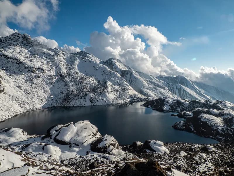
The Gosainkunda Lake Trek climbs from the Trishuli valley north of Kathmandu to a cluster of high glacial lakes in Langtang National Park, then crosses the Lauribina La pass and descends through the Helambu region back towards the Kathmandu valley. It makes a loop that needs no flights and starts and ends within a day's drive of the capital. Gosainkunda itself, at about 4,380 m, is a pilgrimage site for both Hindus and Buddhists. Thousands of pilgrims walk up for the Janai Purnima full-moon festival in July–August, while for most of the year the lakeshore is quiet, with a few lodges and a small temple. The approach passes through forest of oak, fir and rhododendron, the monastery and cheese-making settlement around Sing Gompa, and the ridge at Laurebina with views across to the Langtang, Ganesh and Manaslu ranges. Beyond the lakes the trail crosses Lauribina La at about 4,610 m, the highest point of the trek, and drops into Helambu, where Hyolmo and Tamang villages sit on forested ridges above terraced fields. It suits fit walkers who have done a multi-day trek before and want altitude, culture and solitude without the long approach of the eastern routes. Licence-verified guides you contact directly can tell you how they pace the climb to the lakes and the pass.

πŸ“– View Details & Itinerary

πŸ“… Duration: 9-12 Days

πŸ”οΈ Max Altitude: 4610m

πŸ“ Permit: Standard Parks

Helambu Trek
Langtang Regioneasy

Helambu Trek

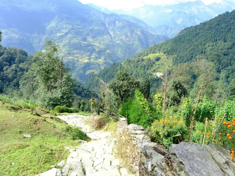
The Helambu Trek starts at the edge of the Kathmandu Valley and needs no flight: a short drive to Sundarijal and you are walking. The route climbs through Shivapuri-Nagarjun National Park to Chisapani, follows a long forested ridge north via Kutumsang to its high point at Tharepati, then drops into the Melamchi valley and the villages of Melamchigaon, Tarkeghyang and Sermathang before finishing at Melamchi Bazaar. Helambu is the homeland of the Hyolmo (Yolmo) people, Tibetan Buddhist communities with their own language and some of the region's oldest monasteries, at Tarkeghyang and Melamchigaon. Their stone houses, prayer walls and apple orchards give the second half of the trek its character, and homestays are available in several villages. At under 3,700 m, altitude is rarely a problem, and the trek works in the shoulder months and in winter when higher routes are cold or snowbound. The trade-off is views: the Langtang, Gauri Shankar and Jugal ranges show best from the ridge around Tharepati and on clear mornings in autumn. It suits trekkers with a week to spare, families, and anyone wanting a first teahouse trek close to Kathmandu. Licence-verified guides you contact directly can suggest how to shorten or extend the loop.

πŸ“– View Details & Itinerary

πŸ“… Duration: 7-10 Days

πŸ”οΈ Max Altitude: 3640m

πŸ“ Permit: Standard Parks

Langtang Valley Trek
Langtang Regionmoderate

Langtang Valley Trek

The Langtang Valley Trek is the closest major trek to Kathmandu. A day's drive north brings you to Syabrubesi, and from there the trail follows the Langtang Khola upstream through Langtang National Park to Kyanjin Gompa, a small monastery settlement surrounded by glaciers and the peaks of Langtang Lirung. The lower valley is steep-sided and forested with oak, rhododendron and bamboo, home to langur monkeys and, more rarely, red pandas. Higher up it opens into a broad glacial valley of yak pastures, stone walls and prayer flags. The people here are largely Tamang, with strong Tibetan cultural ties, and you pass mani walls, chortens and the rebuilt village of Langtang, which was destroyed by a landslide in the 2015 earthquake. From Kyanjin Gompa most trekkers spend a day climbing Kyanjin Ri or Tserko Ri for wide views over the Langtang range. The trek suits people with around a week who want high mountain scenery without flying in or out. The trail is steady rather than technical, with daily walking of four to seven hours, and the route out and back along the same valley keeps logistics simple. A licence-verified local guide you contact directly can arrange transport, permits and lodges and set a pace that allows for acclimatisation.

πŸ“– View Details & Itinerary

πŸ“… Duration: 7-10 Days

πŸ”οΈ Max Altitude: 4773m

πŸ“ Permit: Standard Parks

Langtang Valley and Gosainkunda Lake Trek
Langtang Regionhard

Langtang Valley and Gosainkunda Lake Trek

The Langtang Valley and Gosainkunda Trek joins two of the best-known walks north of Kathmandu into one loop. The first half follows the Langtang Khola from Syabrubesi through forest to Langtang village and Kyanjin Gompa, where a day on Kyanjin Ri (about 4,773 m) gives close views of Langtang Lirung and the peaks along the Tibetan border. The second half turns south and climbs from Thulo Syabru through Sing Gompa to the high lakes of Gosainkunda, about 4,380 m. The two halves feel different. Langtang is a broad glacial valley of Tamang villages, yak pastures and mani walls, rebuilt after the 2015 earthquake. Gosainkunda is a cluster of glacial lakes sacred to Hindus and Buddhists, busy during the Janai Purnima festival in July or August and quiet for most of the year. The route suits trekkers with good fitness who want variety without flights, since both ends are reached by road from Kathmandu. Teahouses are simple but regular. The climb to Gosainkunda is steep and gains height quickly, so the itinerary spends a night at Laurebina before the lakes. Licence-verified guides you contact directly can tell you how they pace the two halves and whether they add the crossing of Lauribina La to Helambu.

πŸ“– View Details & Itinerary

πŸ“… Duration: 12-14 Days

πŸ”οΈ Max Altitude: 4773m

πŸ“ Permit: Standard Parks

Langtang Valley with Tserko Ri Trek
Langtang Regionhard

Langtang Valley with Tserko Ri Trek

This version of the Langtang trek is planned around the high ground above Kyanjin Gompa rather than the walk to it. After the usual approach up the Langtang Khola from Syabrubesi, it gives you three full days based at Kyanjin: a first climb of Kyanjin Ri (about 4,773 m) to acclimatise, a long day to the summit of Tserko Ri (about 4,984 m), and a walk up the valley towards Langshisa Kharka and the Langtang glacier. Tserko Ri is a non-technical trekking peak, but it is a big day: a steep climb of more than 1,100 m from Kyanjin and back, much of it on loose ground above the last yak pastures. From the top you look across the Langtang Lirung massif, the glaciers spilling off Langtang II and Gangchenpo, and north towards the Tibetan border ranges. The extra nights at Kyanjin are what make the summit realistic; they give your body time to adjust before you go above 4,500 m. The trek suits people who have walked at altitude before and want a summit without ropes or climbing gear. You need good fitness and a willingness to start early, often before dawn, when the views are clearest and before afternoon cloud builds. Licence-verified guides you contact directly can judge the weather and your acclimatisation on the day, and turn the summit attempt around if conditions or your health call for it.

πŸ“– View Details & Itinerary

πŸ“… Duration: 10-12 Days

πŸ”οΈ Max Altitude: 4984m

πŸ“ Permit: Standard Parks

Lauribina Pass Trek
Langtang Regionhard

Lauribina Pass Trek

The Lauribina Pass Trek walks out of the Kathmandu Valley on foot and climbs north to the pass from its quieter, southern side. It starts at Sundarijal on the valley rim, crosses Shivapuri-Nagarjun National Park to Chisapani, and follows the long ridge of Helambu through Hyolmo and Tamang villages before rising into the high country at Tharepati, Ghopte and Phedi. From Phedi you cross Lauribina La (about 4,610 m) and drop to the sacred lakes of Gosainkunda, then descend through Sing Gompa to the road at Dhunche. Doing the route in this direction puts the cultural part first and the altitude later. The first days are spent on forested ridges with long views back to the Kathmandu Valley and ahead to the Langtang and Jugal ranges. The climb to the pass is then concentrated into a few steep days, so the itinerary includes a short day to Phedi before the crossing to help you acclimatise. The upper section between Tharepati and Gosainkunda is remote, with simple lodges and no villages, and the pass can hold snow well into spring. It suits trekkers who are comfortable with long ascents and want a traverse that ends at the lakes rather than starting there. Licence-verified guides you contact directly can advise on snow conditions on the pass and whether your pace allows an extra night before the crossing.

πŸ“– View Details & Itinerary

πŸ“… Duration: 10-12 Days

πŸ”οΈ Max Altitude: 4610m

πŸ“ Permit: Standard Parks

Tamang Heritage Trail Trek
Langtang Regioneasy

Tamang Heritage Trail Trek

The Tamang Heritage Trail is a short loop through the villages of Rasuwa district, west of the Langtang valley and close to the Tibetan border. It starts and ends at Syabrubesi, a day's drive from Kathmandu, and links Gatlang, Tatopani, Nagthali, Thuman and Briddim β€” settlements of the Tamang community, whose language, dress and Buddhist practice are closely related to those across the border. The walking is moderate and stays below about 3,200 m, so altitude is rarely a concern. What sets the route apart is the time spent in villages rather than at viewpoints: stone houses with carved wooden windows, monasteries, natural hot springs at Tatopani, and evenings in community-run homestays where meals are cooked by the host family. From the meadow at Nagthali there are views across to the Langtang range and Ganesh Himal on clear days. It suits trekkers who want culture as much as mountains, families, and anyone with a week who would rather avoid the busier trails. It also combines well with the Langtang Valley, which starts from the same trailhead. Homestay standards vary from village to village, so expect simple rooms and shared facilities. Licence-verified guides you contact directly can arrange the homestays and explain local customs along the way.

πŸ“– View Details & Itinerary

πŸ“… Duration: 7-10 Days

πŸ”οΈ Max Altitude: 3165m

πŸ“ Permit: Standard Parks

Find a licensed guide who works in the Langtang region and arrange your trek with them directly.

Trekking in the Langtang region

Langtang is one of the closest major trekking areas to Kathmandu. Most treks start at Syabrubesi, about 122 km north of the capital: seven to eight hours by jeep, longer by bus, with no domestic flight needed. That makes it a good choice when time is short or you would rather not depend on mountain airstrips.

The treks lie mostly in Langtang National Park, gazetted in 1976 as Nepal's first Himalayan national park and covering about 1,710 kmΒ². Above the valley rises Langtang Lirung, at about 7,234 m (published heights vary by a few metres). The people here are mainly Tamang, and their culture, and that of the Tibetan Buddhist villages higher up, is one of the reasons to come.

The valley also carries a hard history. On 25 April 2015 the Gorkha earthquake set off a huge avalanche and air blast that buried Langtang village and killed more than 300 people.

Choosing a Langtang trek

  • Langtang Valley follows the river up to Kyanjin Gompa, with its monastery and cheese factory, in about a week.
  • Langtang Valley with Tserko Ri adds the climb from Kyanjin to the summit of Tserko Ri, the highest point of any Langtang trek we list.
  • Gosainkunda Lake climbs to a group of high lakes around 4,380 m that are sacred to Hindus and Buddhists. Thousands of pilgrims come at the Janai Purnima full moon in August, and the lakes have been a Ramsar wetland since 2007.
  • Langtang Valley and Gosainkunda combines the two in about two weeks.
  • Lauribina Pass crosses from the Gosainkunda lakes over the pass and down into Helambu.
  • Helambu is a lower loop of Hyolmo villages and forest close to Kathmandu, walkable into early winter.
  • Tamang Heritage Trail visits Tamang villages such as Gatlang and the hot springs at Tatopani, with homestays along the way.

Permits and guides

None of the Langtang treks enter a restricted area. They need the Langtang National Park entry permit, and the Helambu side is in Shivapuri-Nagarjun National Park. The Nepal Tourism Board lists the Langtang, Gosainkunda, Helambu and Tamang Heritage routes among those that need a licensed guide and a TIMS card, so plan to walk with a guide. Each trek page shows its fee total in rupees.

Langtang Trekking FAQ

How many treks are in the Langtang region?

xTrekka currently features 7 treks in the Langtang region, ranging from 7–12 days in length and reaching up to 4,984 m.

How difficult are Langtang treks?

Langtang treks range across easy to hard difficulty. Each trek page lists its difficulty grade, max altitude and daily itinerary so you can match a route to your experience.

Do I need special permits for Langtang?

No restricted-area permit is needed on the Langtang treks listed here: they use national park or conservation area entry permits, with a TIMS card on some routes. Each trek page shows its permit fees in rupees with an approximate dollar figure. See our guide to Nepal trekking permits for every fee and rule.

When is the best time to trek in Langtang?

Most Langtang treks are best in Mar–May, Oct–Nov. Outside those months, expect monsoon rain from June to September and cold, snow-prone passes in winter. Each trek page shows its own best months. Compare every route in our month-by-month guide to trekking in Nepal.

Plan your Langtang trek