Tamang Heritage Trail Trek at a glance
How the grades compare across routes: Nepal trek difficulty grades explained.
Overview
The Tamang Heritage Trail is a short loop through the villages of Rasuwa district, west of the Langtang valley and close to the Tibetan border. It starts and ends at Syabrubesi, a day's drive from Kathmandu, and links Gatlang, Tatopani, Nagthali, Thuman and Briddim — settlements of the Tamang community, whose language, dress and Buddhist practice are closely related to those across the border.
The walking is moderate and stays below about 3,200 m, so altitude is rarely a concern. What sets the route apart is the time spent in villages rather than at viewpoints: stone houses with carved wooden windows, monasteries, natural hot springs at Tatopani, and evenings in community-run homestays where meals are cooked by the host family. From the meadow at Nagthali there are views across to the Langtang range and Ganesh Himal on clear days.
It suits trekkers who want culture as much as mountains, families, and anyone with a week who would rather avoid the busier trails. It also combines well with the Langtang Valley, which starts from the same trailhead. Homestay standards vary from village to village, so expect simple rooms and shared facilities. Licence-verified guides you contact directly can arrange the homestays and explain local customs along the way.
🌟 Trail Highlights
- Homestays with Tamang families in Gatlang and Briddim
- Natural hot springs at Tatopani
- Views of Langtang Lirung and Ganesh Himal from Nagthali
- Thuman village and its monastery
- Timure, on the old trade route to Tibet
- A short, low-altitude loop from a road-accessible trailhead
Tamang Heritage Trail Trek itinerary
- Day 1
Kathmandu to Syabrubesi
Drive north via Trishuli and Dhunche to Syabrubesi, the trailhead for both this loop and the Langtang Valley. The road is long and winding in the hills.
- Day 2
Syabrubesi to Gatlang
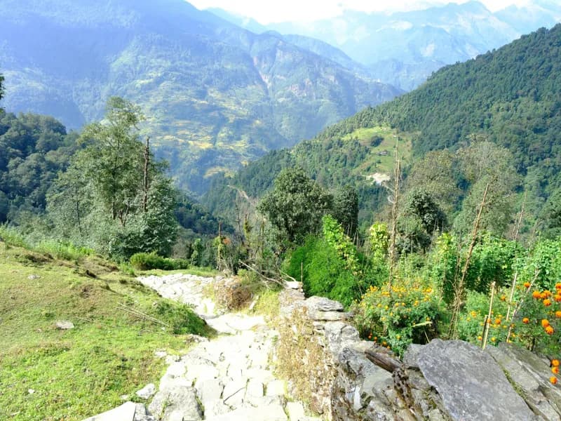
Climb out of the Bhote Koshi valley through terraced farmland to Gatlang, one of the larger Tamang villages. The afternoon can be spent in the village, which has a monastery and traditional stone houses.
- Day 3
Gatlang to Tatopani
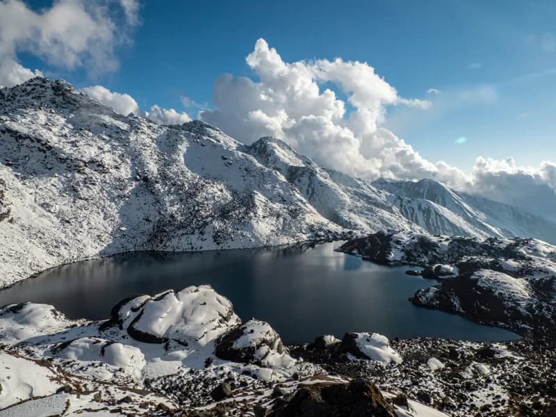
Pass Parvati Kunda lake, then descend and climb again through small settlements to Tatopani. The village is known for its natural hot springs, a good place to rest tired legs.
- Day 4
Tatopani to Thuman via Nagthali
Climb to the open meadow of Nagthali, the high point of the trek, for views of the Langtang and Ganesh Himal ranges, then descend to Thuman. Thuman's monastery and village life make a good evening stop.
- Day 5
Thuman to Timure
Descend toward the Bhote Koshi and walk up the valley to Timure, close to the Tibetan border and the old Rasuwagadhi fort. This was a stop on the historic trade route between Kathmandu and Kyirong.
- Day 6
Timure to Briddim
Walk back down the valley and climb to Briddim, a village known for its community homestay programme. Hosts often share local food and dances in the evening.
- Day 7
Briddim to Syabrubesi
A short descent through forest and farmland returns to Syabrubesi. Some trekkers continue from here into the Langtang Valley instead of driving back.
- Day 8
Syabrubesi to Kathmandu
Drive back to Kathmandu along the same road. Allow a spare day in the monsoon, when landslides can close the road.
This trek climbs above 3,000 m, where the pace of the climb matters. See our guide to altitude sickness on Nepal treks for how to prevent, spot and respond to it.
Best time to trek
The best months for the Tamang Heritage Trail Trek are Mar–May, Oct–Nov.
- Jan
- Feb
- Mar
- Apr
- May
- Jun
- Jul
- Aug
- Sep
- Oct
- Nov
- Dec
How does it compare with other routes? See our month-by-month guide to trekking in Nepal.
Permits & costs
- Permit & park fees
- NPR 5,000 per person (≈ US$32)
- Guide day rates
- $25–$35 per day, set by the guides below
- Langtang National Park (NPR 3,000, about USD 19): shown at the Dhunche checkpost on the way to Syabrubesi; parts of this loop, such as the Thuman and Briddim side, sit in the park's buffer zone.
- TIMS card (NPR 2,000, about USD 13): the Nepal Tourism Board names the Tamang Heritage Trek among the routes that need a licensed guide and a card issued by a registered agency.
- Near the Tibet border: TAAN lists part of Gosaikunda rural municipality as a restricted area. No current source says the standard Gatlang–Nagthali–Timure loop needs a restricted-area permit; ask your agency if your itinerary goes beyond Timure.
- Fees change; confirm current rates before you travel.
Every fee and rule, trek by trek: our guide to Nepal trekking permits. Which routes need a licensed guide: do you need a guide to trek in Nepal? What a day rate covers, tips and flights: how much a trekking guide costs in Nepal.
Getting there & back
Road update, October 2026: floods on 26 August swept away the road bridges at Betrawati and Syabrubesi, where this loop begins and ends. Jeeps have crossed a temporary bridge at Betrawati since 11 October, but Syabrubesi is still cut off by road and trail sections in the area were damaged. Ask your guide whether the loop is open and where to start before you arrange transport.
This is a loop, so it begins and ends in Syabrubesi: a long day's drive of about 120 km from Kathmandu through Trishuli and the Dhunche checkpost, quicker by private jeep than by bus. From Syabrubesi the first walking day heads west towards Gatlang rather than up the Langtang valley. Allow a spare day for the return, as the Rasuwa road is prone to monsoon landslides.
📸 Trail Checkpoints & Scenery Gallery

Tamang Heritage Trail Trek FAQs
How difficult is the Tamang Heritage Trail?
It is an easy-to-moderate trek. Days are four to seven hours with some steep climbs between villages, but the route stays below about 3,200 m and needs no technical skills. Walkers with reasonable fitness manage it comfortably.
Is altitude sickness a concern?
Rarely. The highest point, Nagthali, is around 3,165 m, and most nights are spent between about 1,500 and 2,600 m. Still, drink plenty of water and tell your guide if you feel unwell on the climb to Nagthali.
Do I need a guide?
A licensed guide is required for trekking inside national parks under rules in force since April 2023, and part of this loop is in Langtang National Park's buffer zone. Even where enforcement is light, a guide makes homestay arrangements and village visits much easier, and can translate.
What permits do I need?
Plan on the Langtang National Park permit (NPR 3,000), checked at Dhunche, and a TIMS card (NPR 2,000), which the Nepal Tourism Board requires on this route along with a licensed guide. No current source requires a restricted-area permit for the standard loop. Confirm the current list with your agency before you travel.
When is the best time to go?
Spring (March to May) and autumn (October to November) bring the clearest views and settled weather. Winter is possible at these altitudes but cold at night. The monsoon (June to September) brings leeches and road closures.
What is the accommodation like?
Most nights are in community homestays or small family lodges. Rooms are simple, bathrooms are often shared and outside, and meals are home-cooked dal bhat and local dishes. Bring a sleeping bag for colder nights.
Can I combine it with the Langtang Valley?
Yes. Both routes start from Syabrubesi, so many trekkers walk the Tamang Heritage loop first and then continue up the Langtang Valley, which adds about a week and higher ground.
Guides who lead the Tamang Heritage Trail Trek
Every one of them is licence-verified by our compliance team. Open a profile to read about them, then send your dates — they reply to you directly with their own price.