Manaslu Circuit Trek at a glance
How the grades compare across routes: Nepal trek difficulty grades explained.
Overview
The Manaslu Circuit loops around Mount Manaslu (8,163 m), climbing the Budhi Gandaki gorge from the warm middle hills, crossing the Larkya La at roughly 5,100 m, and descending into the Marsyangdi valley on the far side. Because the upper valley is a restricted area, trekkers walk with a licensed guide and a permit, which keeps numbers well below those on the Annapurna and Everest routes.
The first days follow a narrow river valley through terraced villages, suspension bridges and stretches of trail cut into the cliffside. Above Deng the culture shifts: mani walls, chortens and Tibetan Buddhist villages such as Lho, Samagaon and Samdo, where yak herding and barley fields replace rice terraces. Manaslu fills the skyline from Lho onwards.
Days are typically five to seven hours of walking, with two rest days built in for acclimatisation before the pass. Pass day is the long one: an early start from Dharamsala (Larkya Phedi), a steady climb over moraine to prayer flags at the top, then a steep descent to Bimthang.
The trek suits walkers with some multi-day hiking behind them who are comfortable with basic teahouses and cold nights at altitude. No technical climbing is involved, but snow on the pass can make conditions harder outside the main seasons. A licence-verified guide you contact directly can adjust the pace and acclimatisation days to your group.
Deciding between routes? Manaslu Circuit vs Annapurna Circuit: Which to Choose
🌟 Trail Highlights
- Crossing the Larkya La (about 5,100 m) with views of Himlung and the Annapurna peaks
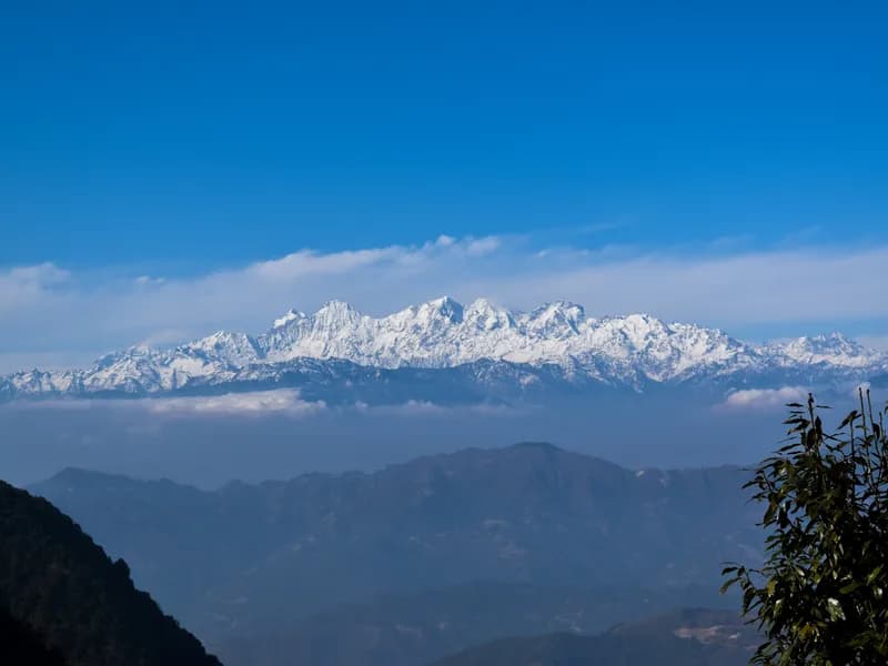
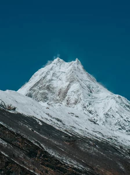
- Close views of Manaslu from Lho and Samagaon
- Tibetan Buddhist villages, monasteries and mani walls in the Nubri valley
- The Budhi Gandaki gorge, from subtropical forest to high alpine meadow
- Acclimatisation hike towards Manaslu Base Camp or Pungyen Gompa
- Far fewer trekkers than the main Annapurna and Everest trails
Manaslu Circuit Trek itinerary
- Day 1
Drive Kathmandu to Machha Khola
A long drive west via Dhading Besi or Arughat and Soti Khola, with the last section on a rough, unpaved road along the Budhi Gandaki. Expect a full day in the jeep or bus.
- Day 2
Machha Khola to Jagat
Follow the river upstream past hot springs at Tatopani and cross several suspension bridges. Permits are checked at Jagat, the entry point to the restricted area.
- Day 3
Jagat to Deng
The trail climbs through Philim and past the turn-off to the Tsum Valley, entering a narrower, forested section of the gorge. Deng is a small settlement at the edge of the Nubri region.
- Day 4
Deng to Namrung
Climb steadily through forest and small Gurung and Tibetan villages, with the first mani walls and chortens along the trail. Namrung has good teahouses and the first wide mountain views.
- Day 5
Namrung to Lho
A shorter day through Lihi and Sho, with barley fields and stone houses. Lho's monastery looks straight at Manaslu, best seen in the early morning.
- Day 6
Lho to Samagaon
A gentle climb to Shyala and on to Samagaon, the largest village in the upper valley. Arrive early enough to rest and adjust to the altitude.
- Day 7
Acclimatisation day in Samagaon
Hike up towards Manaslu Base Camp or to Pungyen Gompa and return to sleep in Samagaon, following the climb-high, sleep-low principle. Birendra Lake is an easier option for a lighter day.
- Day 8
Samagaon to Samdo
A short walk up the widening valley to Samdo, the last permanent village before the pass and close to the Tibetan border.
- Day 9
Acclimatisation day in Samdo
A second rest day before the pass. Many groups hike part of the way towards the Tibetan border trail or the ridge above the village for views, then return to Samdo.
- Day 10
Samdo to Dharamsala (Larkya Phedi)
Climb gradually across the Larkya glacier's outwash to the basic lodge at Dharamsala. Rest, eat well and go to bed early for the pass.
- Day 11
Cross the Larkya La to Bimthang
Start before dawn and climb over moraine to the top of the Larkya La, marked with prayer flags. The descent to Bimthang is steep and long, but the views of Himlung, Cheo Himal and Annapurna II make up for it.
- Day 12
Bimthang to Tilije
Descend through rhododendron and pine forest into the Dudh Khola valley, with views back to Manaslu. Tilije is a Gurung village at the end of the forest section.
- Day 13
Tilije to Dharapani, drive to Besisahar
A short walk joins the Annapurna Circuit trail at Dharapani. From there, take a shared or private jeep down the Marsyangdi valley to Besisahar.
- Day 14
Drive Besisahar to Kathmandu
Drive back to Kathmandu by bus or jeep along the Prithvi Highway, arriving in the afternoon or evening.
This trek climbs above 3,000 m, where the pace of the climb matters. See our guide to altitude sickness on Nepal treks for how to prevent, spot and respond to it.
Best time to trek
The best months for the Manaslu Circuit Trek are Mar–May, Oct–Nov.
- Jan
- Feb
- Mar
- Apr
- May
- Jun
- Jul
- Aug
- Sep
- Oct
- Nov
- Dec
How does it compare with other routes? See our month-by-month guide to trekking in Nepal.
Permits & costs
- Permit & park fees
- US$115 + NPR 8,000 per person (≈ US$167 in total)
- Area
- Restricted: a special permit is required
- Guide day rates
- $25–$40 per day, set by the guides below
- Manaslu restricted-area permit: priced by season. From September to November it is USD 100 for the first week inside the zone and USD 15 for each extra day; from December to August, USD 75 for the first week and USD 10 a day after that. This itinerary spends about 8 days in the zone, so expect about USD 115 in autumn.
- Manaslu Conservation Area Permit (MCAP): NPR 3,000 (about USD 19), covering the Budhi Gandaki valley up to Larkya La.
- Annapurna Conservation Area Permit (ACAP): NPR 3,000 (about USD 19). You need it because, after crossing Larkya La, the trail descends through Bimthang to Dharapani inside the Annapurna Conservation Area.
- TIMS card: NPR 2,000 (about USD 13); the Nepal Tourism Board lists the Manaslu Circuit as a licensed-guide and TIMS route.
- The restricted permit comes only through a registered agency applying to the Department of Immigration, and you walk with a licensed guide. A single trekker has been able to apply since 22 March 2026.
- Seasonal rates mean the same trek costs less in spring than in autumn, so confirm the dates on your permit match your plan.
Every fee and rule, trek by trek: our guide to Nepal trekking permits. Which routes need a licensed guide: do you need a guide to trek in Nepal? What a day rate covers, tips and flights: how much a trekking guide costs in Nepal.
Getting there & back
Trail update, October 2026: around 11 October a flood on the Budhi Gandaki swept away bridges, including the road bridge at Soti, and destroyed sections of the trail between Jagat and Philim, the way into this route. More than 100 trekkers were stranded near Jagat and some were flown out by helicopter. No reopening date had been announced as of 20 October, so check the state of the route with your guide before you book.
Most groups drive from Kathmandu to Machha Khola (or Soti Khola) by jeep or local bus, a full day of 8–10 hours with the final stretch on a rough dirt road. At the end, jeeps run from Dharapani down to Besisahar in about 3–4 hours, and buses or jeeps continue to Kathmandu (6–8 hours) or Pokhara. Landslides can close the Budhi Gandaki and Marsyangdi roads during and just after the monsoon, so leave a spare day at either end.
📸 Trail Checkpoints & Scenery Gallery

Manaslu Circuit Trek FAQs
How hard is the Manaslu Circuit Trek?
It is a strenuous trek: most days involve 5–7 hours of walking on uneven trails, and pass day over the Larkya La can take 8–10 hours. No technical climbing is needed, but you should be comfortable walking several consecutive long days. Some prior multi-day hiking and regular cardio training beforehand make a real difference.
Do I need a guide for the Manaslu Circuit?
Yes. The upper Budhi Gandaki valley is a restricted area, so the special permit is only issued through a registered trekking agency, and you must walk with a licensed guide. Since 22 March 2026 a single trekker can get the permit (previously a group of at least two was required), but solo independent trekking is still not permitted on this route.
What permits do I need?
You need the Manaslu Restricted Area Permit, the Manaslu Conservation Area Permit, and the Annapurna Conservation Area Permit for the descent into the Marsyangdi valley. Your agency arranges the restricted permit; bring passport copies and photos. Fees vary by season and change from time to time, so confirm current rates.
How do I avoid altitude sickness on this trek?
The itinerary includes rest days in Samagaon and Samdo before the pass, which is the most important protection. Ascend gradually, drink plenty of water, avoid alcohol at altitude and tell your guide early about headaches, nausea or dizziness. If symptoms worsen, the only reliable treatment is to descend.
When is the best time to trek Manaslu?
October and November usually bring the clearest skies and stable weather; March to May is the second season, with warmer days and rhododendrons in bloom lower down. Snow can close or complicate the Larkya La in winter, and the monsoon (June–September) brings rain, leeches and landslides on the lower trail.
What is the accommodation like?
The route is a teahouse trek: simple lodges with twin rooms, shared toilets and a heated dining room. Facilities become more basic higher up, and Dharamsala before the pass has very limited rooms that fill quickly in peak season. Meals are mainly dal bhat, noodles, potatoes and eggs.
Is there phone signal, Wi-Fi and charging?
Mobile coverage is patchy and absent in places, especially above Samagaon. Some lodges offer paid Wi-Fi or charging, which can be slow or unavailable when solar power is low. Carry a power bank and expect to be offline for a few days.
Guides who lead the Manaslu Circuit Trek
Every one of them is licence-verified by our compliance team. Open a profile to read about them, then send your dates — they reply to you directly with their own price.