Upper Dolpo Trek at a glance
How the grades compare across routes: Nepal trek difficulty grades explained.
Overview
The Upper Dolpo Trek crosses the remote trans-Himalayan region of Dolpo in north-western Nepal, behind the Dhaulagiri and Kanjiroba ranges. From the airstrip at Juphal it follows the Thuli Bheri and Suli Gad valleys to Phoksundo Lake, then climbs over Kang La (Nagdalo La) to Shey Gompa, the Crystal Monastery, before looping east through Saldang and south over Jeng La to the Tarap valley and back to Dunai.
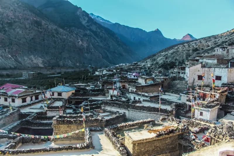
North of Phoksundo the landscape turns high and dry: wide barley fields, stone villages, gompas of the Bon and Buddhist traditions, and long stretches with no settlement at all. Days often run above 4,000 m and cross passes over 5,000 m, and weather on the passes can hold a group up.
This is largely a camping trek. Ringmo, Dunai and a few villages have basic lodges or homestays, but on the high section your team carries tents, food and fuel. Upper Dolpo is a restricted area, so it is arranged through a registered agency with a licensed guide, and the permit is charged by the day.
It suits experienced trekkers who are comfortable with three weeks away from roads, long days and simple food, and who want a quiet route through a culture that has changed slowly. Licence-verified guides you contact directly can explain how they run the crossing, the camping logistics and the flight back-up plan.
Deciding between routes? Upper Dolpo vs Lower Dolpo: Which Dolpo Trek to Choose
🌟 Trail Highlights
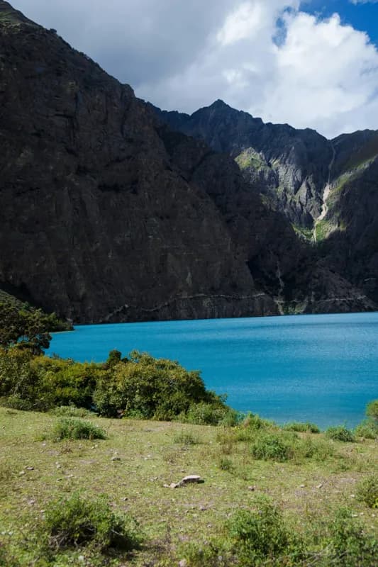
- Turquoise Phoksundo Lake and the village of Ringmo
- Crossing Kang La (Nagdalo La) at about 5,350 m
- Shey Gompa, the Crystal Monastery
- The Bon and Buddhist villages of Saldang and Namduna
- Crossing Jeng La into the Tarap valley
- Long, quiet days far from any road
Upper Dolpo Trek itinerary
- Day 1
Fly Kathmandu to Nepalgunj
Fly or drive to Nepalgunj on the southern plains, the gateway for flights into Dolpa. The day is mostly travel and permit checks.
- Day 2
Fly to Juphal, trek to Dunai
A short mountain flight lands at Juphal; the trail then drops through fields to the Thuli Bheri and follows it to Dunai, the district headquarters.
- Day 3
Dunai to Ankhe
Walk up the Suli Gad valley past walnut groves and small villages, entering Shey Phoksundo National Park, where permits are checked.
- Day 4
Ankhe to Sulighat
The trail rises and falls along forested slopes above the river, with a few steep sections and simple campsites.
- Day 5
Sulighat to Ringmo (Phoksundo Lake)
Climb past a high waterfall to the first view of Phoksundo Lake and the village of Ringmo on its shore.
- Day 6
Rest and acclimatisation at Phoksundo
Visit Ringmo and the Tshowa Bon monastery by the lake, and take a short walk higher to help acclimatisation.
- Day 7
Phoksundo Lake to Phoksundo Khola
Follow a narrow trail cut into the cliff along the western shore, then enter the Phoksundo Khola valley. From here the route is camping only.
- Day 8
Phoksundo Khola to Nagdalo La high camp
Leave the valley floor and climb towards the pass, camping below it at Phoksundo Bhanjyang.
- Day 9
Cross Kang La (Nagdalo La) to Shey Gompa
An early start for the long climb to the pass at about 5,350 m, then a steep descent into the Shey valley and the Crystal Monastery.
- Day 10
Rest day at Shey Gompa
Explore Shey Gompa, the nearby Tsakang hermitage and the Crystal Mountain that draws pilgrims around it.
- Day 11
Shey Gompa to Namduna Gaun via Saldang La
Cross the Saldang La into wide, arid country and descend to Namduna Gaun and its monastery.
- Day 12
Namduna Gaun to Saldang
A gentle walk across open slopes to Saldang, one of the largest villages in Upper Dolpo, spread along a terrace above the river.
- Day 13
Saldang to Yangze Gompa
Follow the Nagon Khola to Yangze, a remote Bon monastery, through a landscape of eroded cliffs and small fields.
- Day 14
Yangze Gompa to Sibu
Return towards Saldang and continue down-valley past chortens and mani walls to camp near Sibu.
- Day 15
Sibu to Jeng La Phedi
Climb gradually up a side valley to camp at the foot of Jeng La.
- Day 16
Cross Jeng La to Tokyu
Cross Jeng La at about 5,080 m with views back to Dhaulagiri, then descend into the Tarap valley to Tokyu.
- Day 17
Tokyu to Dho Tarap
A short walk down the broad valley to Dho Tarap, the main village of Tarap, with Bon and Buddhist gompas.
- Day 18
Rest day at Dho Tarap
Explore the village and its monasteries before starting the long descent.
- Day 19
Dho Tarap to Tarap Khola
Descend through a narrowing gorge with juniper and wild rose to camp by the Tarap river.
- Day 20
Tarap Khola to Khanigaon
Continue down the gorge on a trail cut into the rock in places, with several bridges.
- Day 21
Khanigaon to Tarakot
A shorter day down to Tarakot, an old fortress village above the Thuli Bheri.
- Day 22
Tarakot to Dunai
Follow the Thuli Bheri back to Dunai, closing the loop.
- Day 23
Dunai to Juphal, fly out
Walk up to Juphal and fly to Nepalgunj, connecting onward to Kathmandu when flights allow.
This trek climbs above 3,000 m, where the pace of the climb matters. See our guide to altitude sickness on Nepal treks for how to prevent, spot and respond to it.
Best time to trek
The best months for the Upper Dolpo Trek are May–Oct.
- Jan
- Feb
- Mar
- Apr
- May
- Jun
- Jul
- Aug
- Sep
- Oct
- Nov
- Dec
How does it compare with other routes? See our month-by-month guide to trekking in Nepal.
Permits & costs
- Permit & park fees
- US$600 + NPR 5,000 per person (≈ US$632 in total)
- Area
- Restricted: a special permit is required
- Guide day rates
- $30–$40 per day, set by the guides below
- Upper Dolpo Restricted Area Permit: charged at USD 50 per person per day. The paid days start where the trail enters the restricted zone along the Phoksundo Khola and end in Dho Tarap; on this itinerary that is about 12 days, or roughly USD 600. Any extra day inside the zone, for weather or rest, adds another USD 50.
- Shey-Phoksundo National Park: NPR 3,000 (about USD 19), the entry fee for the park around Phoksundo Lake and the route north of it.
- TIMS card: NPR 2,000 (about USD 13), arranged by your agency.
- Agency and guide: the permit can only be applied for through a registered trekking agency, which obtains it from the Department of Immigration in Kathmandu, and a licensed guide has to accompany you. Since 22 March 2026 the permit has been available to one person; before that, applications needed two.
- Because the restricted fee is per day, agree the full itinerary with your agency before the permit is issued.
Every fee and rule, trek by trek: our guide to Nepal trekking permits. Which routes need a licensed guide: do you need a guide to trek in Nepal? What a day rate covers, tips and flights: how much a trekking guide costs in Nepal.
Getting there & back
Fly from Kathmandu to Nepalgunj (about 1 hour), usually staying a night there, then take the short mountain flight to Juphal (about 35–45 minutes) on a small plane. Juphal flights are often delayed or cancelled by weather and the airport occasionally closes after incidents, so leave two or three spare days at the end. The road via Jumla or Dunai exists but is long and seasonal.
📸 Trail Checkpoints & Scenery Gallery

Upper Dolpo Trek FAQs
How hard is the Upper Dolpo Trek?
It is one of the more demanding treks in Nepal: three weeks on foot, several days above 4,000 m and two passes over 5,000 m (Kang La and Jeng La), with long, cold days. It suits trekkers who already have multi-day high-altitude experience and are comfortable camping.
Do I need a guide and a permit?
Yes. Upper Dolpo is one of Nepal's restricted areas, so a registered agency has to obtain the permit, and a licensed guide travels with you, usually alongside a camping crew. Since 22 March 2026 you can be the only trekker on the permit; previously two were required. Independent trekking is not permitted.
How much are the permits?
Every day inside the restricted zone costs USD 50 per person; this itinerary has about 12 such days, so around USD 600. On top of that come the Shey-Phoksundo National Park fee (NPR 3,000, about USD 19) and a TIMS card (NPR 2,000, about USD 13). Extra days spent in the zone waiting out weather add to the bill, so build them into the plan.
Is it a teahouse or camping trek?
Mostly camping. Dunai, Ringmo and a few lower villages have basic lodges or homestays, but north of Phoksundo your team carries tents, kitchen equipment, food and fuel.
When is the best time to go?
Late May to October. Dolpo lies in the rain shadow of the Dhaulagiri range, so it stays relatively dry in the monsoon months, which is when the high passes are most reliably open. Snow can close Kang La and Jeng La from late autumn to spring.
How do I avoid altitude sickness?
The itinerary builds in rest days at Phoksundo, Shey Gompa and Dho Tarap and climbs gradually towards each pass. Drink plenty, walk slowly, and tell your guide early about headaches or nausea; the reliable treatment is to descend.
What if the Juphal flight is cancelled?
It happens often. Plan two or three spare days at the end of the trip, ask your agency how they handle rebooking, and keep international flights flexible.
Guides who lead the Upper Dolpo Trek
Every one of them is licence-verified by our compliance team. Open a profile to read about them, then send your dates — they reply to you directly with their own price.
Guides On
Languages
Guides On
Languages
More guides working in Dolpa
These guides haven't listed the Upper Dolpo Trek specifically, but they work this region — ask them whether they lead it.