Dolpa region trekking scenery
πŸ”οΈ 4 Treks

Dolpa Region Treks

Dolpo treks in remote western Nepal: Phoksundo Lake, Upper Dolpo's Shey Gompa, Rara Lake and the crossing to Mustang, with permits and summer seasons.

πŸ₯Ύ
Treks
4
πŸ”οΈ
Max Altitude
5350m
πŸ“Š
Difficulty
Moderate to Hard
πŸ“…
Duration
10–20 days
πŸ“
Permits
Restricted area

Treks in Dolpa

Dolpo and Mustang Trek
Dolpa Regionhard

Dolpo and Mustang Trek

The Dolpo to Mustang traverse crosses the trans-Himalayan plateau from west to east, finishing in the Kali Gandaki valley at Jomsom. It begins like other Dolpo treks, flying to Juphal and walking up to Phoksundo Lake, then goes north over Kang La to Shey Gompa. From there, instead of looping back south, it heads east through Saldang and the high villages of Shimen and Tinje to Chharka Bhot, one of the most isolated settlements in Nepal, and crosses a chain of passes above 5,000 m via Sangda into Mustang. This is an expedition-style camping trek. For about two weeks there are no lodges: an agency supplies tents, food, a cook and pack animals, and much of the route is above 4,000 m. Several days involve long climbs, river crossings and few settlements, and the walk out over the Sangda passes is one of the hardest days. The reward is a continuous journey through a Tibetan cultural landscape that few people cross on foot: Bon and Buddhist gompas, barley fields, salt-trade trails and wide, wind-carved valleys. Road building in parts of Mustang is changing the last section, so some operators now exit over the Ghami La into Upper Mustang instead. It suits experienced trekkers who have done long camping routes at altitude and can set aside three weeks or more. Licence-verified guides you contact directly can tell you which exit they use and how they handle the permits for both regions.

πŸ“– View Details & Itinerary

πŸ“… Duration: 18-22 Days

πŸ”οΈ Max Altitude: 5350m

πŸ“ Permit: Restricted (β‰ˆ US$652 in permits)

Lower Dolpa Trek (Shey Phoksundo Lake Trek)
Dolpa Regionmoderate

Lower Dolpa Trek (Shey Phoksundo Lake Trek)

The Lower Dolpo circuit is a two-week loop in Nepal's far west that links the Tarap valley with Phoksundo Lake. From the Juphal airstrip it follows the Thuli Bheri river to Dunai and Tarakot, then climbs a long gorge to Dho Tarap, a cluster of stone villages and gompas at around 4,000 m. From Tarap it crosses two high passes on consecutive days, Numa La and Baga La, before dropping through birch and juniper to the turquoise water of Phoksundo at Ringmo. It is a shorter, cheaper way into Dolpo than the Upper Dolpo trek: the restricted-area permit here is charged by the week rather than by the day, and the route stays south of Shey Gompa. What it shares with the north is the feel of the place, Bon and Buddhist monasteries, mani walls, yak caravans and very few other trekkers. The two passes are the crux. Both are above 5,000 m, the days are long, and they come after only a few nights at altitude, so an acclimatisation day in Dho Tarap matters. Lodges exist in Dunai, Ringmo and some villages, but most nights between Tarap and Phoksundo are spent camping or in very basic homestays. It suits fit trekkers with some high-altitude experience who want a remote route without committing three weeks. Licence-verified guides you contact directly can explain how they handle the camping stretch and the flights.

πŸ“– View Details & Itinerary

πŸ“… Duration: 10-14 Days

πŸ”οΈ Max Altitude: 5190m

πŸ“ Permit: Restricted (β‰ˆ US$57 in permits)

Rara Lake and Dolpo Trek
Dolpa Regionhard

Rara Lake and Dolpo Trek

This route joins two of far-west Nepal's lakes. It starts in Dolpo at the Juphal airstrip, climbs the Suli Gad valley to Phoksundo Lake, then turns west over Kagmara La, a 5,115 m pass on the edge of Shey-Phoksundo National Park, and descends into the Jumla district. From the old trading town of Jumla it continues north over forested ridges to Rara, Nepal's largest lake, inside Rara National Park, and flies out from the small Talcha airstrip. The two halves feel very different. The Dolpo side is high and sparse, with Tibetan-influenced villages and the deep blue of Phoksundo. Kagmara La is the single big climb. West of it the trail runs through pine and rhododendron forest, terraced Hindu villages and wide meadows, ending at a lake ringed by blue pine with very few visitors. This is a camping trek for most of its length. Apart from Dunai, Ringmo, Jumla and the park area at Rara, accommodation is in tents, and supplies are carried. Distances between villages can be long, and both airstrips depend on the weather. It suits trekkers who want a long, quiet route across a part of Nepal that sees few foreigners and who are comfortable with one high pass and many days in tents. Licence-verified guides you contact directly can explain how they run the crossing and the logistics between the two airstrips.

πŸ“– View Details & Itinerary

πŸ“… Duration: 18-24 Days

πŸ”οΈ Max Altitude: 5115m

πŸ“ Permit: Restricted (β‰ˆ US$77 in permits)

Upper Dolpo Trek
Dolpa Regionhard

Upper Dolpo Trek

The Upper Dolpo Trek crosses the remote trans-Himalayan region of Dolpo in north-western Nepal, behind the Dhaulagiri and Kanjiroba ranges. From the airstrip at Juphal it follows the Thuli Bheri and Suli Gad valleys to Phoksundo Lake, then climbs over Kang La (Nagdalo La) to Shey Gompa, the Crystal Monastery, before looping east through Saldang and south over Jeng La to the Tarap valley and back to Dunai. North of Phoksundo the landscape turns high and dry: wide barley fields, stone villages, gompas of the Bon and Buddhist traditions, and long stretches with no settlement at all. Days often run above 4,000 m and cross passes over 5,000 m, and weather on the passes can hold a group up. This is largely a camping trek. Ringmo, Dunai and a few villages have basic lodges or homestays, but on the high section your team carries tents, food and fuel. Upper Dolpo is a restricted area, so it is arranged through a registered agency with a licensed guide, and the permit is charged by the day. It suits experienced trekkers who are comfortable with three weeks away from roads, long days and simple food, and who want a quiet route through a culture that has changed slowly. Licence-verified guides you contact directly can explain how they run the crossing, the camping logistics and the flight back-up plan.

πŸ“– View Details & Itinerary

πŸ“… Duration: 20-24 Days

πŸ”οΈ Max Altitude: 5350m

πŸ“ Permit: Restricted (β‰ˆ US$632 in permits)

Find a licensed guide who works in the Dolpa region and arrange your trek with them directly.

Trekking in Dolpo

Dolpa district, usually spelled Dolpo for the region, is the most remote trekking area we list: high, dry valleys in western Nepal behind the Dhaulagiri range, reached by small planes and long days on foot. Much of it lies in Shey-Phoksundo National Park, established in 1984 and, at about 3,555 kmΒ², Nepal's largest national park. It is home to blue sheep and snow leopards.

The people of Dolpo follow Tibetan Buddhism and the older Bon religion. Peter Matthiessen's book The Snow Leopard (1978) describes his 1973 walk to Shey Gompa with the biologist George Schaller, and the Oscar-nominated film Himalaya (1999, released in some countries as Caravan) was shot here with local villagers.

The treks

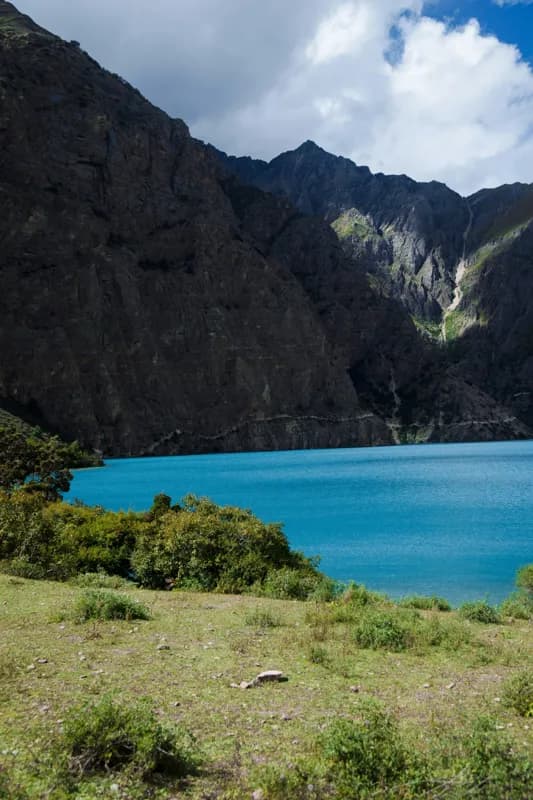
  • Lower Dolpa walks to Phoksundo Lake, about 3,612 m up, a vivid blue lake surveyed at between 136 and 145 m deep and often described as Nepal's deepest. It has been a Ramsar wetland since 2007. Lower Dolpo was the part of the region opened to foreigners in 1989.
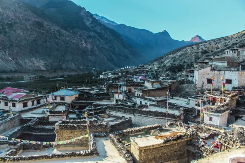
  • Upper Dolpo continues north over high passes to Shey Gompa and villages such as Saldang, in what is still one of Nepal's least visited areas.
  • Dolpo and Mustang crosses from Upper Dolpo eastwards to the Kali Gandaki, a long traverse between two rain-shadow regions.
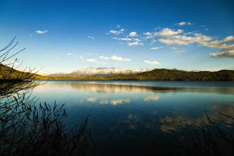
  • Rara Lake and Dolpo links Dolpo with Rara Lake in Mugu district. At about 10.8 kmΒ², Rara is the largest lake in Nepal, set in Rara National Park, the country's smallest national park.

Getting there and seasons

Most Dolpo treks start at Juphal airport, reached by flights from Nepalgunj; weather closes it for days at a time, so build spare days into any itinerary. Because Dolpo sits in the rain shadow, its trek pages recommend late spring through autumn, including the summer monsoon months, when much of the rest of Nepal is wet. Winter closes the high passes.

Permits and guides

All four treks enter restricted areas, so they need a Department of Immigration permit, issued through a registered agency with a licensed guide, plus the Shey-Phoksundo National Park fee (and Rara National Park for the Rara route). Upper Dolpo's permit is far more expensive than Lower Dolpo's. The current rates for each route are on its trek page and in our Nepal trekking permits guide.

Dolpa Trekking FAQ

How many treks are in the Dolpa region?

xTrekka currently features 4 treks in the Dolpa region, ranging from 10–20 days in length and reaching up to 5,350 m.

How difficult are Dolpa treks?

Dolpa treks range across moderate to hard difficulty. Each trek page lists its difficulty grade, max altitude and daily itinerary so you can match a route to your experience.

Do I need special permits for Dolpa?

Yes. Every Dolpa trek listed here enters a restricted area, so on top of the park or conservation area fee you need a restricted-area permit, issued through a registered trekking agency with a licensed guide. Each trek page shows its permit fees in rupees with an approximate dollar figure. See our guide to Nepal trekking permits for every fee and rule.

When is the best time to trek in Dolpa?

Most Dolpa treks are best in May–Oct. Much of the region lies in the drier rain shadow north of the main Himalayan range, so its treks are recommended even in the summer monsoon (June–August), when most of Nepal is wet. Each trek page shows its own best months. Compare every route in our month-by-month guide to trekking in Nepal.

Plan your Dolpa trek