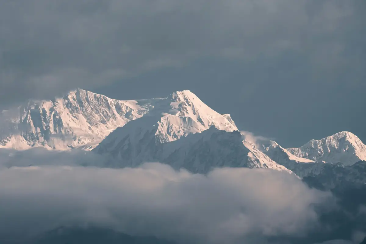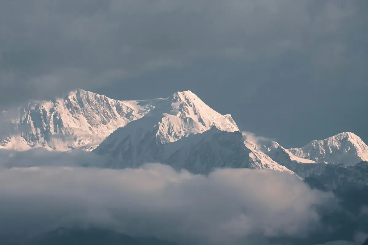
Kangchenjunga Base Camp Trek at a glance
How the grades compare across routes: Nepal trek difficulty grades explained.
Overview
The Kangchenjunga Base Camp Trek visits both sides of the world's third-highest mountain in Nepal's far east. From Taplejung the route follows the Tamur and Ghunsa valleys through Rai, Limbu and Tibetan-influenced villages to Ghunsa, Khambachen and Lhonak, with a day trip to Pangpema, the north base camp at about 5,143 m. It then crosses the Sele La and Mirgin La passes to the south side, where a day walk from Ramche or Cheram reaches Oktang and the Yalung glacier.
Kangchenjunga is a restricted area, so the trek is arranged through a registered agency with a licensed guide. Lodges are simpler and further apart than on the Everest or Annapurna routes, and some nights may be in very basic teahouses. The approach alone takes about a week, climbing from rice terraces and cardamom fields through bamboo and rhododendron forest, and the itinerary builds in acclimatisation days at Ghunsa and Khambachen before the high ground around Lhonak.
It suits trekkers who want a long, quiet route with few other groups and are comfortable with three weeks on the trail. Licence-verified guides you contact directly can tell you how they handle permits, the pass crossings and the long approach.
🌟 Trail Highlights
- Pangpema, the north base camp (about 5,143 m), below Kangchenjunga's north face
- Oktang and the Yalung glacier on the south side
- Crossing Sele La, Sinion La and Mirgin La with views of Jannu
- Tibetan-influenced Ghunsa and the Limbu and Rai villages of the Tamor valley
- Rhododendron and bamboo forest on the long approach
- Very few other trekkers, even in the main seasons
Kangchenjunga Base Camp Trek itinerary
- Day 1
Fly Kathmandu to Bhadrapur, drive to Ilam
A short flight to Bhadrapur in the eastern lowlands, then a 4–5 hour drive up into the tea gardens of Ilam. Overnight in a hotel.
- Day 2
Drive Ilam to Taplejung
A long, winding road through the hills to Taplejung, the district headquarters and the usual start of the trek. Restricted-area permits are checked here.
- Day 3
Drive or trek to Sekathum
Depending on road conditions, a jeep follows the Tamor river towards Sekathum; otherwise the first stretch is walked through terraced Limbu villages. Overnight at the confluence of the Tamor and Ghunsa rivers.
- Day 4
Sekathum to Amjilosa
The trail enters the narrow Ghunsa Khola gorge, climbing steeply in places on a path cut into the valley side. Amjilosa is a small settlement with basic lodges.
- Day 5
Amjilosa to Gyabla
Through bamboo and rhododendron forest with occasional waterfalls, climbing gradually to the Tibetan-influenced village of Gyabla.
- Day 6
Gyabla to Ghunsa
The valley opens out into pasture and larch forest before Ghunsa, the largest village on the route, with a monastery and prayer flags. Most groups stay two nights here.
- Day 7
Acclimatisation day in Ghunsa
A rest day with a short hike above the village to help acclimatise before going higher. Ghunsa has the last reliable supplies on the north side.
- Day 8
Ghunsa to Khambachen
Along the river and across a landslide-prone section below Jannu, reaching the yak pastures of Khambachen with close views of Jannu's north face.
- Day 9
Acclimatisation day in Khambachen
A second rest day at this altitude, with an optional walk towards the Jannu viewpoint. Nights are cold from here on.
- Day 10
Khambachen to Lhonak
The trail crosses moraine and open, stony ground along the Kangchenjunga glacier to Lhonak, a cluster of simple lodges in a wide sandy valley.
- Day 11
Day trip to Pangpema and back to Lhonak
An early start along the glacier's lateral moraine to Pangpema, the north base camp, facing Kangchenjunga's north face. Return to Lhonak the same day.
- Day 12
Lhonak to Ghunsa
A long descent back down the valley to Ghunsa, losing more than 1,300 m in a day.
- Day 13
Ghunsa to Sele Le
A steep climb through forest to the high camp below the Sele La. Lodges here are basic, and some groups camp.
- Day 14
Sele Le to Tseram over the passes
The longest day: crossing Sele La, Sinion La and Mirgin La, with Jannu, Makalu and Kangchenjunga in view, then a long descent to Tseram. Start before dawn.
- Day 15
Tseram to Ramche
A gentle climb up the Yalung valley past moraine and small lakes to Ramche, the base for the south side.
- Day 16
Day trip to Oktang, return to Tseram
Walk along the Yalung glacier to the Oktang viewpoint for the south face of Kangchenjunga, then descend to Tseram.
- Day 17
Tseram to Torongding
Down through dense forest along the Simbuwa Khola. Expect a muddy trail after rain.
- Day 18
Torongding to Yamphudin
Over a forested ridge and down to Yamphudin, a mixed Limbu, Rai and Sherpa village with terraced fields.
- Day 19
Yamphudin to Taplejung
Walk or take a jeep, depending on the road, back to Taplejung.
- Day 20
Drive to Bhadrapur, fly to Kathmandu
A long drive down to the plains and an afternoon flight back to Kathmandu. Leave a spare day in case of road or flight delays.
This trek climbs above 3,000 m, where the pace of the climb matters. See our guide to altitude sickness on Nepal treks for how to prevent, spot and respond to it.
Best time to trek
The best months for the Kangchenjunga Base Camp Trek are Mar–May, Oct–Nov.
- Jan
- Feb
- Mar
- Apr
- May
- Jun
- Jul
- Aug
- Sep
- Oct
- Nov
- Dec
How does it compare with other routes? See our month-by-month guide to trekking in Nepal.
Permits & costs
- Permit & park fees
- US$60 + NPR 4,000 per person (≈ US$86 in total)
- Area
- Restricted: a special permit is required
- Guide day rates
- $25–$35 per day, set by the guides below
- Kanchenjunga restricted-area permit: USD 20 per person per week for the first four weeks, then USD 25 a week. This 20-day itinerary falls inside three weeks, about USD 60, but a weather delay on the walk-out that pushes you into a fourth week adds another USD 20.
- Kangchenjunga Conservation Area Permit (KCAP): NPR 2,000 (about USD 13), the lower conservation-area rate the Nepal Tourism Board lists for this region.
- TIMS card: NPR 2,000 (about USD 13), issued by your agency; the Tourism Board lists the Kanchenjunga base camp routes as needing one and a licensed guide.
- Only a registered trekking agency can obtain the restricted permit from the Department of Immigration, and it is valid only with a licensed guide walking with you. Since 22 March 2026 one trekker on their own can get it.
- Because the route is remote and long, ask your agency to confirm both the permit dates and the current rates when they quote.
Every fee and rule, trek by trek: our guide to Nepal trekking permits. Which routes need a licensed guide: do you need a guide to trek in Nepal? What a day rate covers, tips and flights: how much a trekking guide costs in Nepal.
Getting there & back
Most trekkers fly from Kathmandu to Bhadrapur (about 50 minutes), then drive to Taplejung over one or two days via Ilam. Roads now reach towards Sekathum and Yamphudin, so jeep sections can shorten the approach and exit, but landslides close them regularly in and after the monsoon. Allow a spare day at each end; the return reverses the route to Bhadrapur.
📸 Trail Checkpoints & Scenery Gallery

Kangchenjunga Base Camp Trek FAQs
How difficult is the Kangchenjunga Base Camp Trek?
It is a strenuous, long trek: around three weeks with several 6–9 hour days, a high pass crossing (Sele La and Mirgin La) and two days above 4,700 m. No climbing skills are needed, but you should have done multi-day treks before and train for consecutive long days.
Do I need a special permit and a guide?
Yes. Kangchenjunga is a restricted area, so the permit is issued only through a registered Nepali trekking agency and you must trek with a licensed guide. Since 22 March 2026 a single trekker can apply; before that a group of at least two was required. You also need the Kangchenjunga Conservation Area Permit.
Can I visit just one base camp?
Yes. Shorter itineraries go only to Pangpema (north) and return the same way, or only to Oktang (south). Visiting both by crossing Sele La and Mirgin La is the usual choice for an 18–22 day trip because it avoids retracing the whole route.
What is the accommodation like?
There are basic teahouses at the main stops, but they are simpler and further apart than on the Everest or Annapurna routes, with shared rooms and limited menus. Some groups camp at Sele Le or carry tents as back-up. Expect few hot showers and limited electricity.
How do I avoid altitude sickness on this route?
The itinerary builds in rest days at Ghunsa and Khambachen before Lhonak and Pangpema. Climb slowly, drink plenty of water and tell your guide about headaches, nausea or breathlessness early. If symptoms worsen, the treatment is to descend, and Ghunsa is the nearest lower point from the north side.
When is the best time to go?
October and November usually bring the clearest views and stable weather, and March to May is good for rhododendrons, though afternoon cloud is more common. The monsoon (June–September) brings leeches, landslides and closed roads, and the passes can be snowbound in winter.
Is there mobile coverage and electricity?
Coverage is patchy: you can usually get a signal in Taplejung, Ghunsa and some villages lower down, but not at Lhonak or Pangpema. Most lodges charge devices from solar power for a fee, so bring a power bank.
Guides who lead the Kangchenjunga Base Camp Trek
Every one of them is licence-verified by our compliance team. Open a profile to read about them, then send your dates — they reply to you directly with their own price.