Makalu region trekking scenery
πŸ”οΈ 3 Treks

Makalu Region Treks

Makalu region treks in eastern Nepal: Makalu Base Camp over Shipton La, the Arun Valley and the long traverse to Kanchenjunga, with permits and seasons.

πŸ₯Ύ
Treks
3
πŸ”οΈ
Max Altitude
5159m
πŸ“Š
Difficulty
Moderate to Hard
πŸ“…
Duration
10–24 days
πŸ“
Permits
Restricted area

Treks in Makalu

Arun Valley Trek
Makalu Regionmoderate

Arun Valley Trek

The Arun Valley Trek is a low-altitude traverse of eastern Nepal's middle hills, from the airstrip at Tumlingtar in the Arun valley to Lukla at the gateway to the Khumbu. Instead of heading north to Makalu, it turns west: through terraced farmland and paper-making villages, up to the forested Salpa Bhanjyang pass at about 3,350 m, and across a series of ridges and side valleys before joining the trail below Lukla. Most of the route stays between 1,000 and 3,000 m, so altitude is rarely the limiting factor. The effort comes from the terrain: long climbs and descents between river valleys, often on stone steps, with several passes around 3,000 m on the second half. Villages along the way are home to Rai and Sherpa communities, and much of the accommodation is in homestays and simple lodges rather than the busier teahouses of the Everest trails. It suits trekkers who want a quiet, cultural route with mountain views rather than a high-altitude goal, and those who want to walk into the Everest region instead of flying straight to Lukla. Because it ends at Lukla, it can be extended up to Namche Bazaar or Everest Base Camp. Licence-verified guides you contact directly can suggest how to pace it and whether to continue into the Khumbu.

πŸ“– View Details & Itinerary

πŸ“… Duration: 10-14 Days

πŸ”οΈ Max Altitude: 3350m

πŸ“ Permit: Standard Parks

Makalu Base Camp Trek
Makalu Regionhard

Makalu Base Camp Trek

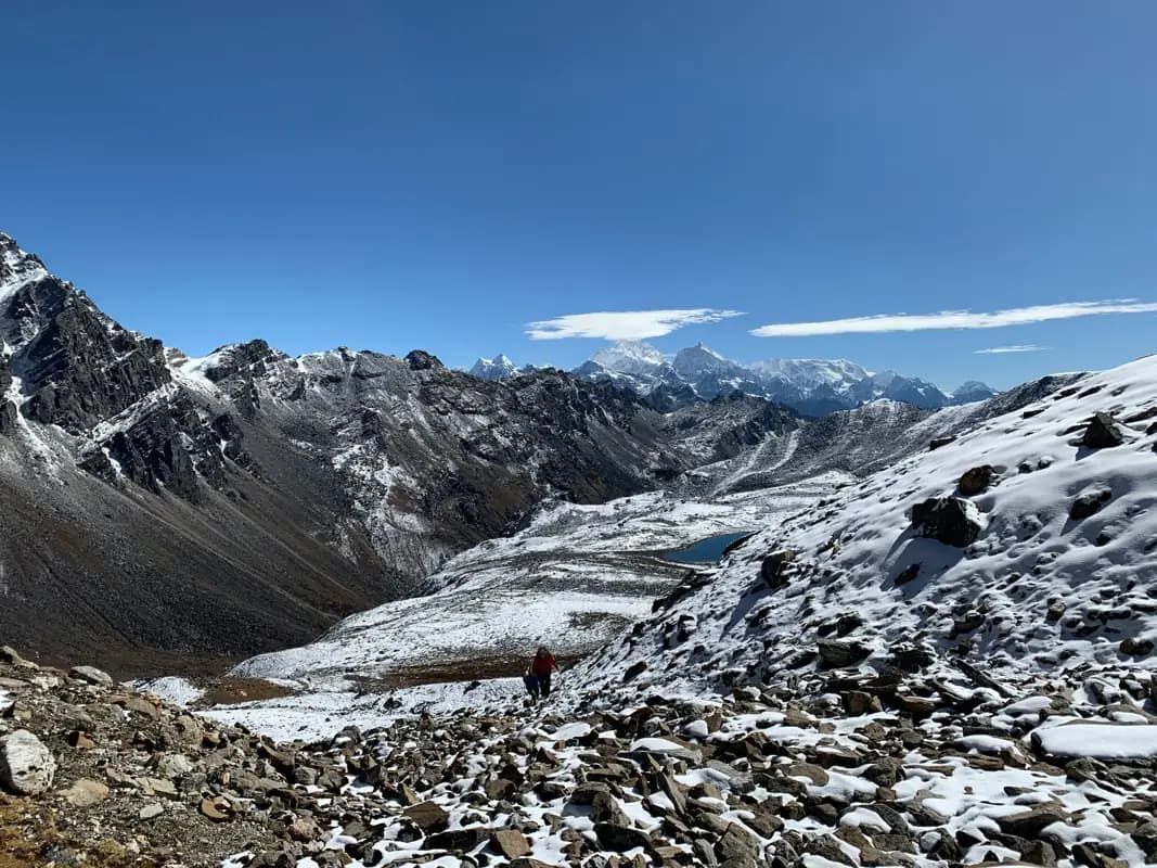
The Makalu Base Camp Trek climbs from the hot, terraced Arun valley to the foot of Makalu, the world's fifth-highest mountain, through Makalu-Barun National Park. From Num the route drops to the Arun river, then climbs through the Rai and Sherpa villages of Seduwa and Tashigaon before crossing the Shipton La area, a high ridge with small lakes, into the upper Barun valley. The Barun valley is the reason most people come. It narrows into a deep glacial trough with granite walls and waterfalls, then opens out below Makalu's south face at base camp, with Chamlang and Baruntse nearby. The national park protects some of Nepal's least disturbed forest, from rhododendron and fir to alpine meadow. Lodges are basic and widely spaced, and the stages over the Shipton La and up the Barun are long, so this is a trek for people who have already done a teahouse route and want a quieter, wilder one. The itinerary includes acclimatisation time at Khongma before the high crossing. Licence-verified guides you contact directly can tell you how they handle the permits, lodges and weather on this route.

πŸ“– View Details & Itinerary

πŸ“… Duration: 18-22 Days

πŸ”οΈ Max Altitude: 4870m

πŸ“ Permit: Standard Parks

Makalu to Kanchenjunga Trek
Makalu Regionhard

Makalu to Kanchenjunga Trek

The Makalu to Kanchenjunga Trek links two of Nepal's most remote eastern regions along the line of the Great Himalaya Trail. It starts from the Arun valley below Makalu, climbs through the Lhomi villages of Hongon and Chyamtang to the summer settlement of Thudam, then crosses the Lumba Sumba pass (about 5,160 m) into the upper Tamor valley. On the far side, Olangchung Gola is an old Tibetan trading village with a long-established monastery, a reminder that these valleys once carried salt and wool across the border. The route then crosses the Nango La to Ghunsa and finishes with the high country of the Kanchenjunga north side, Khambachen, Lhonak and Pangpema, before walking out to Taplejung. This is a long expedition-style trek rather than a teahouse route. Several sections have no lodges and need tents, the trail beyond Chyamtang is overgrown in places and hard to follow, and two restricted areas mean the trip has to be arranged through a registered agency with a licensed guide. In return it crosses country that very few trekkers see, with almost no other groups. Licence-verified guides you contact directly can explain how they supply the camping sections and which direction they prefer.

πŸ“– View Details & Itinerary

πŸ“… Duration: 24-28 Days

πŸ”οΈ Max Altitude: 5159m

πŸ“ Permit: Restricted (β‰ˆ US$125 in permits)

Find a licensed guide who works in the Makalu region and arrange your trek with them directly.

Trekking in the Makalu region

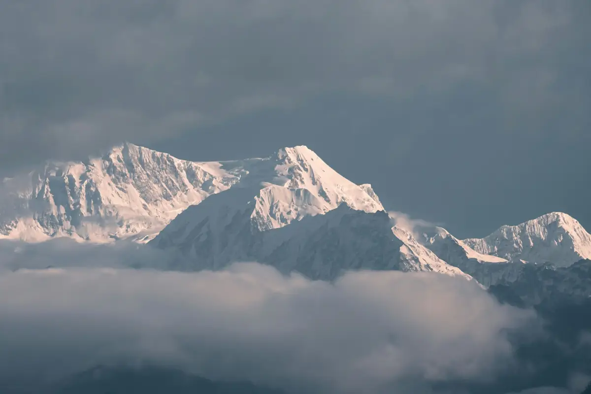
The Makalu region lies in eastern Nepal between the Everest region and Kanchenjunga, beneath Makalu (8,485 m), the world's fifth-highest mountain. Older references give 8,463 m. Its four-sided pyramid stands at the head of the Barun valley, inside Makalu-Barun National Park. The park was established in 1992, covers about 1,500 kmΒ², and has a buffer zone declared in 1999. It runs from subtropical forest in the Arun valley, a few hundred metres above sea level, to glaciers and peaks over 8,000 m. That range makes it one of the most biologically varied protected areas in Nepal.

This is quiet, demanding country. Lodges are fewer and simpler than on the Everest or Annapurna trails, and some stretches use basic teahouses or camping.

The treks

  • Makalu Base Camp starts from the road head beyond Num and climbs through forest to Tashigaon, over the Shipton La (around 4,200 m) and up the Barun valley to the base camp, at about 4,870 m, below Makalu's south face. Allow around three weeks.
  • Arun Valley stays low, following the Arun river through Rai and Sherpa villages, terraced hills and forest. It is a cultural trek with mountain views rather than a high-altitude one, and its trek page recommends it from late winter into spring and again from autumn into December.
  • Makalu to Kanchenjunga is a long east-west traverse linking the two eight-thousanders, part of the Great Himalaya Trail. It is for experienced trekkers with a strong crew.

Getting there

Most Makalu treks begin at Tumlingtar, in Sankhuwasabha district, reached by a domestic flight from Kathmandu or by a long drive, followed by a jeep ride towards Num.

Permits and guides

Makalu Base Camp needs the Makalu-Barun National Park entry permit. Parts of Sankhuwasabha district near the Tibetan border are a restricted area, and whether your route enters them depends on the villages it passes through, so confirm the permits with your agency before booking. The traverse to Kanchenjunga crosses restricted areas and needs Department of Immigration permits. The Nepal Tourism Board lists Makalu Base Camp among the routes that need a licensed guide and a TIMS card. Each trek page shows its fee breakdown; our Nepal trekking permits guide explains how the restricted-area rates work.

Makalu Trekking FAQ

How many treks are in the Makalu region?

xTrekka currently features 3 treks in the Makalu region, ranging from 10–24 days in length and reaching up to 5,159 m.

How difficult are Makalu treks?

Makalu treks range across moderate to hard difficulty. Each trek page lists its difficulty grade, max altitude and daily itinerary so you can match a route to your experience.

Do I need special permits for Makalu?

Only some. Makalu to Kanchenjunga Trek enters a restricted area and needs a restricted-area permit through a registered agency with a licensed guide; the other Makalu treks use standard park or conservation area permits. Each trek page shows its permit fees in rupees with an approximate dollar figure. See our guide to Nepal trekking permits for every fee and rule.

When is the best time to trek in Makalu?

Most Makalu treks are best in Mar–May, Oct–Nov. Outside those months, expect monsoon rain from June to September and cold, snow-prone passes in winter. Each trek page shows its own best months. Compare every route in our month-by-month guide to trekking in Nepal.

Plan your Makalu trek